
Lanark
William Wallace murdered Haselrigg, the English Sheriff of Lanark at the town’s Castle in May 1297. The reason for this act is the subject of dispute. Regardless of why, this single act set Wallace on the path to his destiny; it brought him the support of much of the population, and galvanised ordinary Scots to rally to his flag.
Lanark’s name comes from its woollen industry (from the Norman French, the modern ‘laine’, meaning wool, is related to it); indeed Edward I’s tax on wool in 1296 (to finance a campaign in Flanders) inflamed local opinion and garnered Wallace much local support. The town had a Greyfriars monastery, founded at the time of Robert the Bruce, it was located between Broomgate and Friars Lane. The site of a house reputed to have belonged to Wallace lies opposite the church of St Nicholas at the west end of the High Street (above the door of which a statue of Wallace was placed in the early 19th Century).
An interesting remnant of the period can be found in the rear of one of the properties in the High Street, from Bernards Wynd a 13th Century gothic window can be seen; this was from a stone-built house, probably owned by the monks of Dryburgh (being the best house in the Town, it is likely that Wallace resided there after his defeat of the English forces at Stirling Bridge). In the grounds of Lanark’s old cemetery are the remains of the original St Kentigern’s Church, the south wall and chancel arch are from Wallace’s time.
Narrow by year:
Narrow by tags:
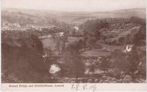
Roman Bridge and Kirkfieldbank
postcardA postcard from the early 20th century showing the Roman Bridge and Kirkfieldbank.
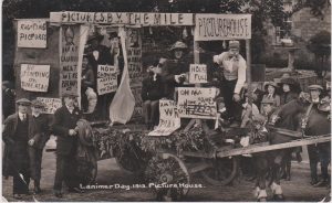
Lanimer Day Float
postcardA postcard from Lanark’s Lanimer Day in 1913, showing a ‘Picture House’ float.
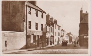
Castlegate
postcardA postcard showing Castlegate, Lanark. Sub-title of, “Where Wallace first drew sword for Scotland”.

Burgh Surveyor’s Map of Lanark
mapThe map is a fascinating glimpse of Lanark just before the outbreak of war in 1914. Interesting features on this map include a plethora of railway lines which include a railway…
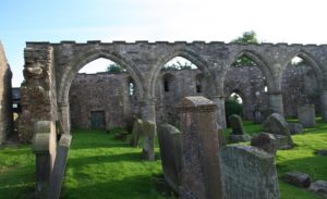
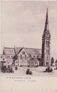
St Kentigern’s Church, Lanark
articleIt is remarkable that in Scotland there is only one medieval church dedicated to St Kentigern under his own proper name. There are many others dedicated to him under the…
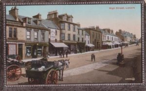
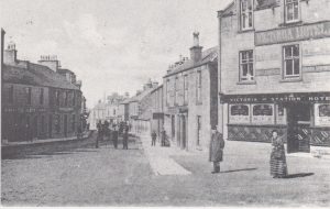
High Street, Lanark
postcardThe old High Street in Lanark was once a great treasure, though, sadly, it has been ruined over the years. This card was sent from Lanark on 26th June, 1914.…