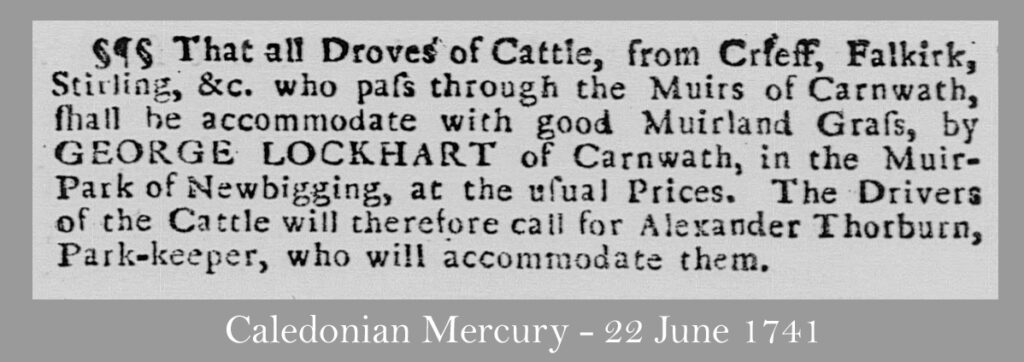
Much of Scotland’s wealth once came from the sale of black cattle, raised in highland glens and islands then driven great distances to the annual trysts at Dunblane and Falkirk. Following the Acts of Union, many English traders bought cattle at the tryst and arranged the cattle’s long journey onwards across the border; some as far as London’s Smithfield market. Covering only ten or twenty miles each day, such arduous journeys took many months, with drovers setting up camp each night and sleeping beneath the stars. These great droves followed customary routes between stances where the cattle could graze at the end of each day’s journey.
Droves originated in an age before land was enclosed by fences and hedges, when there were few roads but many areas of common pasture that offered good grazing. From 1750, changes to land ownership and improvements in agriculture began to transform the landscape, especially in lowland areas. Fences and hedges increasingly constrained the passage of herds, and grazing had to be paid for as areas of commonty – common land – were divided between landowners. The hard surface of new turnpike roads didn’t suit the cattle’s hooves, and drovers had a natural aversion to paying tolls, so the old routes continued to be followed where this was possible.
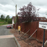
“The Drove Roads of Scotland”, by A.R.B. Haldane was first published in 1952 and remains the definitive history of Scotland’s cattle trade, It includes a map of Scotland’s drove roads, that has been widely reproduced, which shows a single route from the Falkirk tryst towards England, crossing the Pentland Hills by the high pass known as the Cauldstane Slap. There seems substantial evidence however that many drovers followed a more direct route south by way of Bathgate, Whitburn and Longridge before crossing into Clydesdale near Woodmuir, where there was once an area of common grazing. There are paths and roads in various parts of Clydesdale that are still known as “drove loans” and were presumably routes along which cattle were driven to market; however the main route south, and across the border, seems to have passed through Carnwath parish.
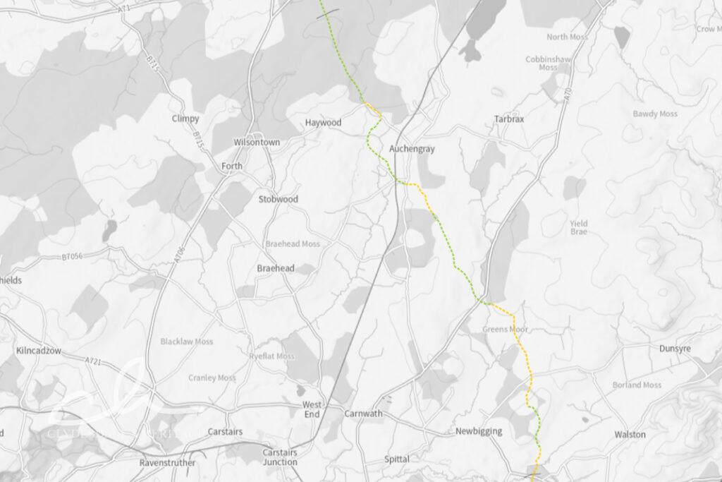
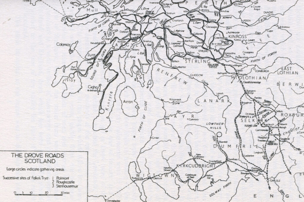
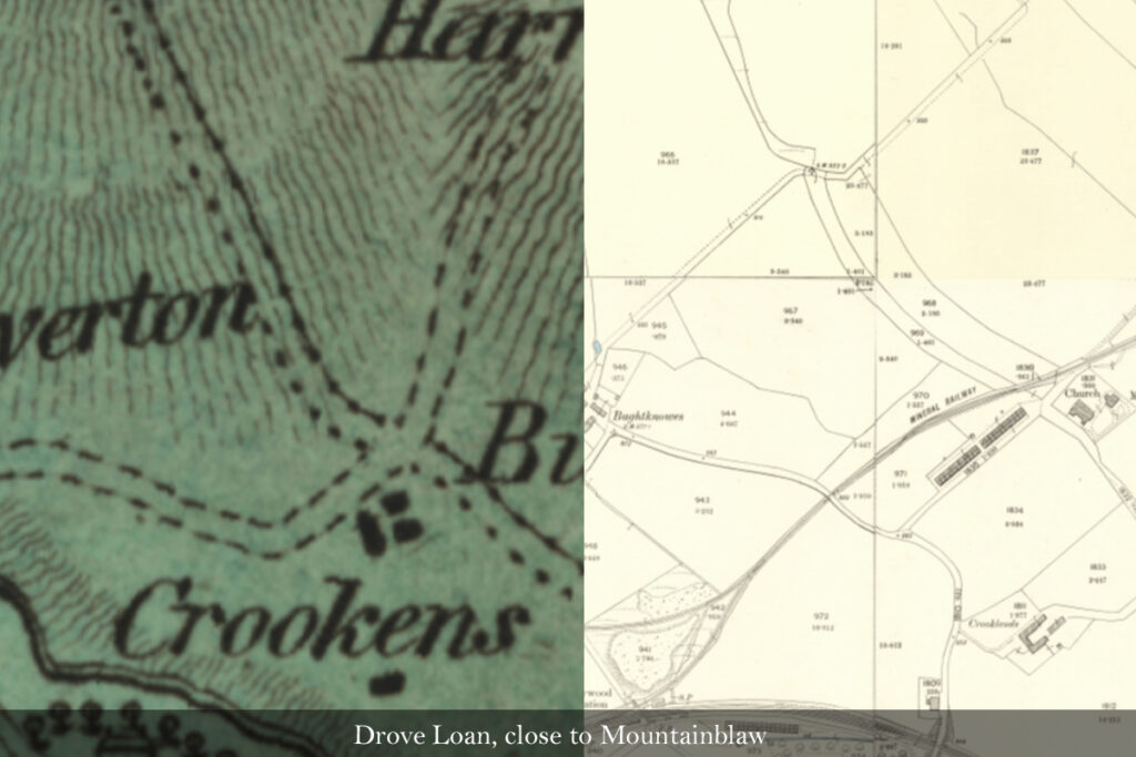
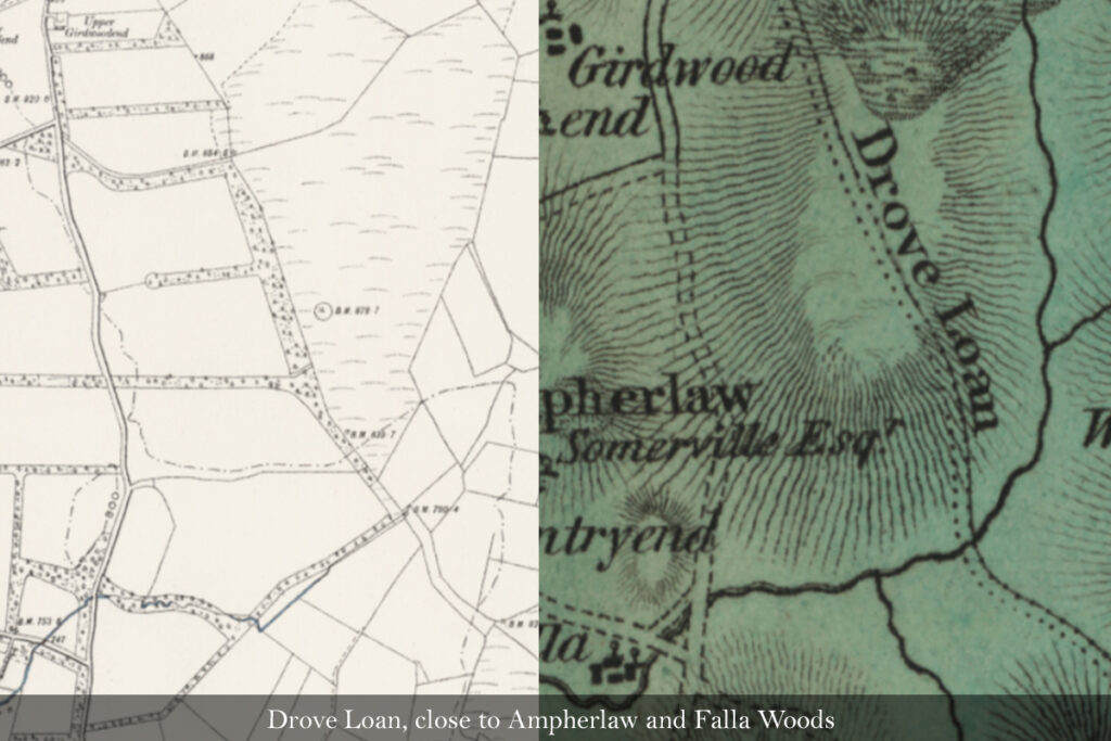
Route of drove loan through Carnwath parish, indicated on Forrest’s map of Lanarkshire, and map from Haldane’s Drove Roads of Scotland, which suggested that all cattle herded south travelled over Coldstaneslap.
The title of Haldane’s excellent book may have unintentionally encouraged use of the term “drove road” rather than “drove loan” used in many documents of the time. This is unfortunate, as “road” now conjures up something built and surfaced, whereas “loan”, (indicating a strip of grazing), better describes the green corridors through the landscape along which cattle were herded.
Forrest’s map of Lanarkshire was published in 1816; at a time when cattle were still being driven to the markets of the south, but following routes closely defined following the enclosure of fields and other agricultural improvements. The map shows three significant lengths of track labelled “drove loan” which seem to have formed a single route running north to south across the parish, usually taking the most direct route rather than following the contours of the land. The coming of the railway quickly superseded the droving of cattle across the lowlands and into England, and the first edition OS map, surveyed in about 1860, shows little evidence of the drove loan through Carnwath parish. The route has been preserved in some field boundaries and farm tracks, but has been lost in most areas of open moorland, or where the development of country estates has radically changed the landscape. In some locations, the strip of land through which the drove loan passed was planted with trees to create shelter belts, and occasionally, the fences that once constrained either side of the drove road survive simply as an oddly narrow field
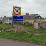
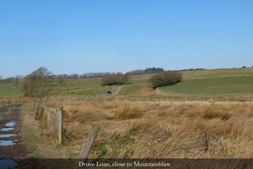
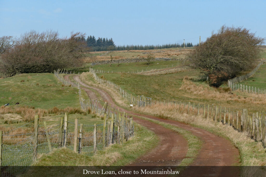
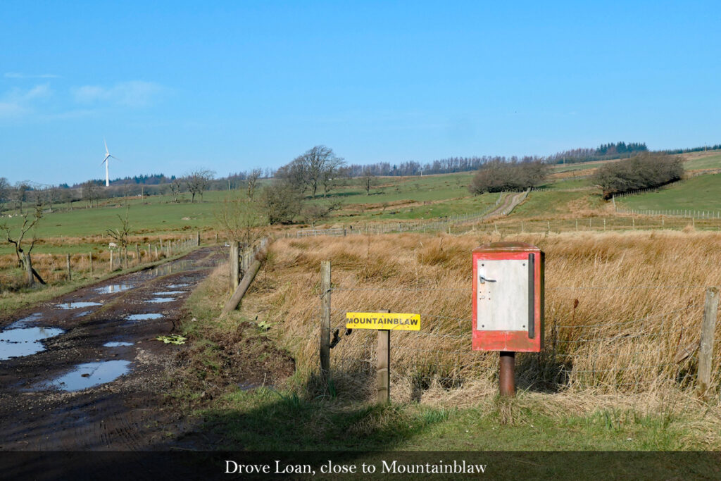
This can be seen to good effect at a couple of places. At Bughtknowes near Haywood, the drove loan descended from the upland around Mountainblaw towards the Haywood burn. Parallel fences and windblown lengths of hedge still define a strip of land through which the drove loan once passed. At one time trees were planted within this strip, and more recently a track has been formed along it to serve Mountainblaw farm.
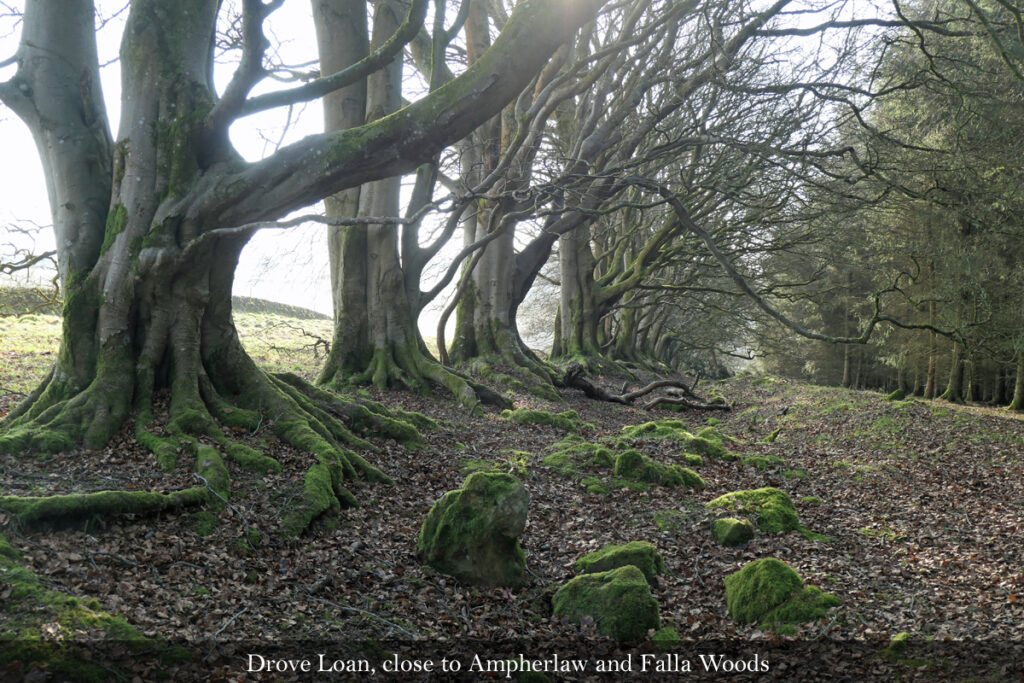
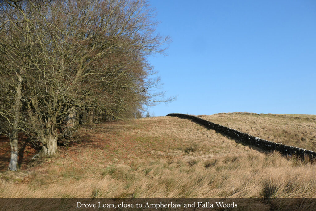
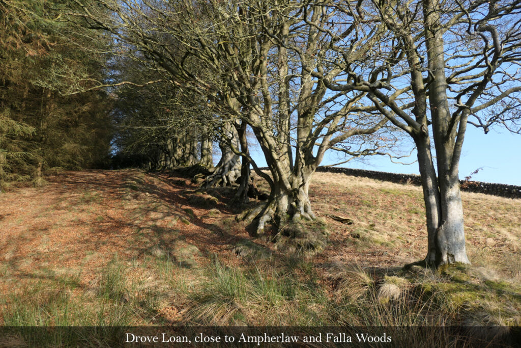
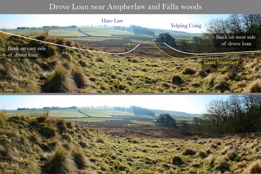
Further to the south, on the edge of the Ampherlaw and Falla woodlands, lies perhaps the best evidence of the drove loan. A fine line of old beech trees, planted on a mound and ditch extends along the edge of the modern plantation, and this boundary continues roughly southwards towards the ridge between Hare Law and Yelping Craigs. The remains of a further ridge and ditch runs parallel to the beech trees, about 100 metres to the east. These two parallel banks seem to define the boundaries of the drove loan. A solid and well maintained stone wall now runs parallel with, and between, the two banks, perhaps defining a new boundary established once the land of the drove loan had been divided between two neighbouring estates?
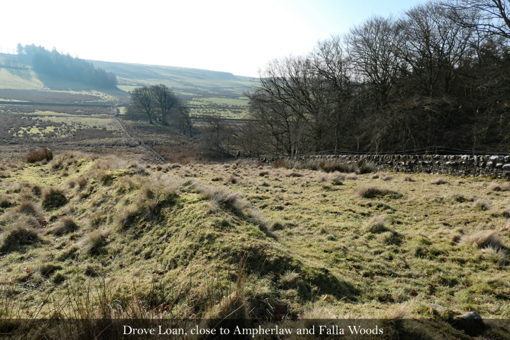
From the viewpoint beneath the beech trees you can gaze across a quiet and ancient landscape, free from main roads and many other distractions of modern life. If you let your imagination wander, it’s not too hard to imagine the noise and bustle of drovers, their dogs, and their herds of hardy black cattle, as they slowly disappear into the distance on their long and fantastic journey to the markets of the south.
Robin Chesters, 23/03/25
Unless otherwise stated, all text, images, and other media content are protected under copyright. If you wish to share any content featured on Clydesdale's Heritage, please get in touch to request permission.