
Lanark
William Wallace murdered Haselrigg, the English Sheriff of Lanark at the town’s Castle in May 1297. The reason for this act is the subject of dispute. Regardless of why, this single act set Wallace on the path to his destiny; it brought him the support of much of the population, and galvanised ordinary Scots to rally to his flag.
Lanark’s name comes from its woollen industry (from the Norman French, the modern ‘laine’, meaning wool, is related to it); indeed Edward I’s tax on wool in 1296 (to finance a campaign in Flanders) inflamed local opinion and garnered Wallace much local support. The town had a Greyfriars monastery, founded at the time of Robert the Bruce, it was located between Broomgate and Friars Lane. The site of a house reputed to have belonged to Wallace lies opposite the church of St Nicholas at the west end of the High Street (above the door of which a statue of Wallace was placed in the early 19th Century).
An interesting remnant of the period can be found in the rear of one of the properties in the High Street, from Bernards Wynd a 13th Century gothic window can be seen; this was from a stone-built house, probably owned by the monks of Dryburgh (being the best house in the Town, it is likely that Wallace resided there after his defeat of the English forces at Stirling Bridge). In the grounds of Lanark’s old cemetery are the remains of the original St Kentigern’s Church, the south wall and chancel arch are from Wallace’s time.
Narrow by year:
Narrow by tags:
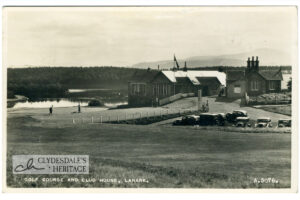
Golf Course and Club House, Lanark
postcardB&W photo postcard, Valentine & Sons, Dundee. A3076. Postmarked 1955. CR25.0003

The Poles in Clydesdale During World War II – a story of courage
articleSince I came to live in Clydesdale, I have been conscious of the important contribution that the Polish Army made in World War II and I feel that this has…
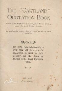
Be sure and secure a copy of “The Cartland Quotations Book”
articleIn an article on 08 July, 1916, the Carluke and Lanark Gazette urged all its readers to “Be sure and secure a copy of “The Cartland Quotation Book“. Few people…
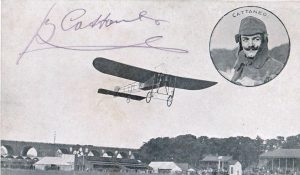
Lanark Aviation Meeting
documentThe Lanark Airshow was the first airshow in Scotland and it was particularly special in that it was also the second British International Airshow. It attracted competitors from all over…
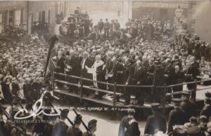
Proclamation of King George V
postcardA view of the proclamation of King George V at Lanark Cross in 1910. All the local dignitaries were there. The Provost of Lanark Town Council read out the proclamation.…
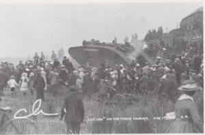
“Julian” on the Moor
postcardThe visit of Julian to Lanark included a visit to the area near Lanark Golf Course. This was not a particularly successful visit as the tank broke down and had…

Sale catalogue from Lanark Auction Market
documentA sale catalogue dating from 1892 from Lawrie & Symington Auctioneers at Lanark Auction Market.
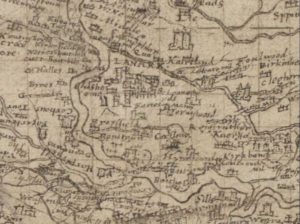
Pont’s Map of Lanark
mapPont’s Map of Lanark from 1596. This map gives an incredible look at the layout of Lanark during the time of James VI of Scotland. By 1596, Lanark had four…
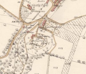
Ordnance Survey map of Lanark Castle
mapThis Ordnance Survey map provides some idea of the layout of Lanark Castle.