
Biggar
According to local legend, William Wallace dressed as a pedlar in order to pass a guarded crossing (Cadger’s Brig) and spy on the English Army camp before the Battle of Biggar. However, there is no evidence that there was anything other than a ford here, and the Battle of Rosslyn happened at the same date (questioning the plausibility of the tale).
Biggar is located within the Barony of the Fleming Family (possibly so-called due to their origin in Flanders, although the family arrived from England at the time of Henry II). In the 12th Century Baldwin the Fleming was Sheriff of Lanarkshire, remains of his Motte castle are to be found in the grounds of Moat Park Manse, the Bailey was destroyed in the 19th Century in order to create a croquet lawn (the skateboard park of its day). No excavations have taken place on the Motte, so its role in the Wars of Independence cannot be determined.
Nearby is the Parish Church of St Mary’s, which was originally constructed in the 12th Century; it was replaced by the building we see today on the same site in 1547. This was to be the last Catholic church constructed in Scotland prior to the Reformation.
Clydesdale’s history is celebrated at the Moat Park Museum, which has a wealth of interesting archaeological exhibits. This is but one of many museums in Biggar, each one amply rewards their visitors with a fascinating array of artifacts.
Narrow by year:
Narrow by tags:

The Poles in Clydesdale During World War II – a story of courage
articleSince I came to live in Clydesdale, I have been conscious of the important contribution that the Polish Army made in World War II and I feel that this has…

Burn Braes
postcardA nice view of the Burn Braes, Biggar. The postcard was produced by J.H. Wilson. The Mill would have been working at the time this picture was taken. The exact…
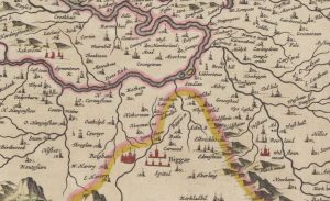
Blaeu map of Biggar
mapThis is another section of the Clydesdale Map – this section was called the Upper Ward. Some interesting bits around Biggar include West and East Hartree represented by towers. Shieldhill…
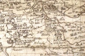
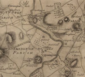
Pont Map of Biggar
mapAn interesting map of Biggar by cartographer Timothy Pont in c. 1596. St Mary’s Church can be seen on the map. Curiously, there are two castles indicated – one showing…
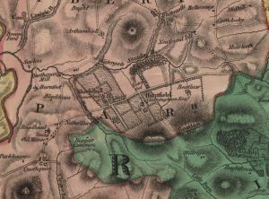
Forest Map of Shieldhill
mapThe Forest Map of 1816 showing Shieldhill contains considerably more detail than William Roy’s map of 1752. The map indicates the growing importance of neighbouring Huntfield. The Chancellors had continued…
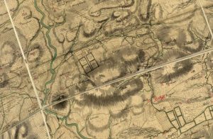
Roy Map of Quothquan and Shieldhill
mapWilliam Roy’s 1752 map of Quothquan and Shieldhill, showing that the area around Shieldhill had several fields surrounded by trees, part of a designated landscape. Quothquan Mill is shown to…
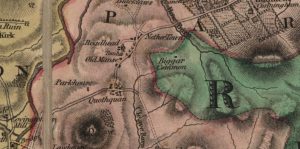
Blaeu map of Quothquan
mapThe 1654 map of Quothquan by Joan Blaeu. The map does not indicate a settlement at Quothquan, instead showing Quothquan Mill (then named ‘Kothoon Mill’). This was shown at a…

Ross Map of Quothquan
mapThe Ross Map of Quothquan from 1773. The map shows clearly the settlement of Quothquan stretching alongside a road from Roadhead Farm. The church is not marked on this map;…
Forest Map of Quothquan
mapThe Forest Map of Quothquan from 1816. This map shows Roadhead as a farm, and also shows that the Manse lay in a field to the west of the ruins…
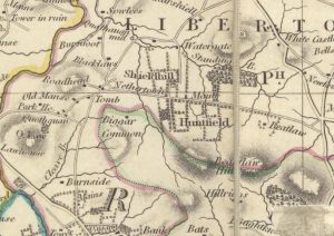
Thomsons Map of Nethertown
mapThomson map of Netherton and surrounding areas from 1832. The map shows more detail than Forest’s map of 1816, particularly in respect of roads. It also shows that Netherton had…