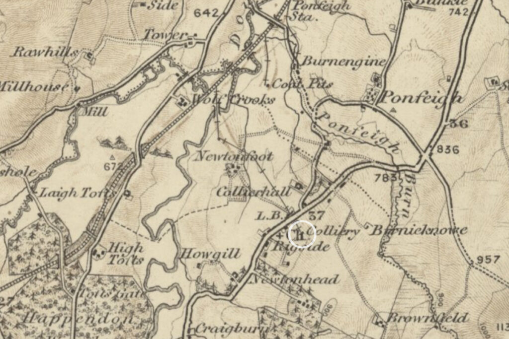
At one time most of the coal used in the upper parishes of Clydesdale, and as far south as Moffat, was carted from pits in Rigside and Ponfeigh. Coal had been worked for many centuries in this area of Douglasdale, however production increased following the opening of the turnpike road from Ayr. The landscape around Rigside has changed substantially since then, however traces of this early phase of mining are still evident in the gentle humps and hollows of the Douglas Water golf course.
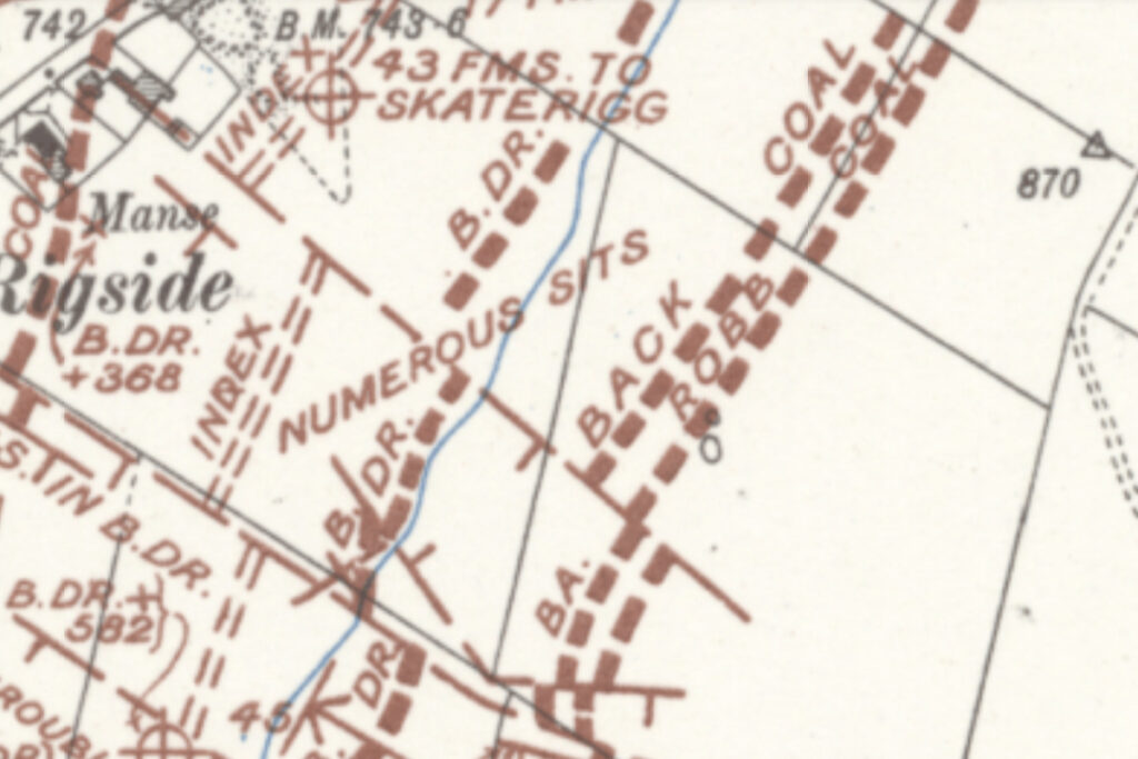
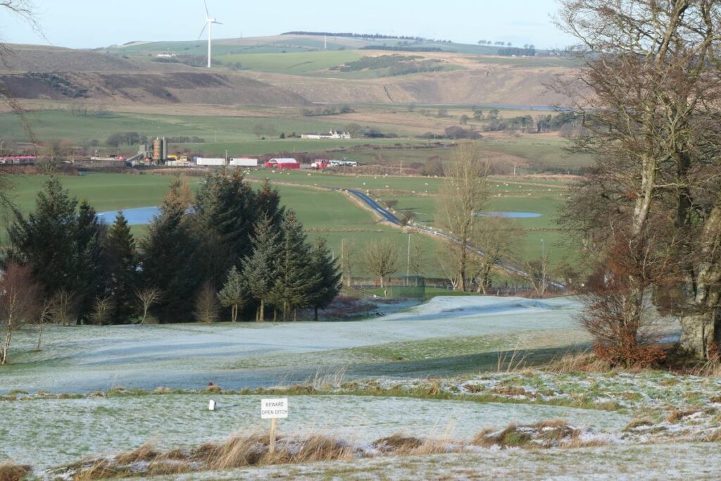
The Ayr road follows the high ground between Hyndford Bridge and Douglas, and at Rigside provides a fine view down the hillside towards Douglas Water and across the coal-bearing lands beyond. The nine seams of coal that lay buried deep beneath this landscape ran fairly level, however at the edge of basin, where the hills rise up to Rigside, these seams were thrust upwards and fractured, and outcrops on the surface at various levels along the hillside. The lowest of the seams – the Robb, Back and Big Drum coals outcropped on the slope above Rigside within lands that are now the golf course. Here the seams dip steeply into the ground at an angle of nearly 45 degrees.

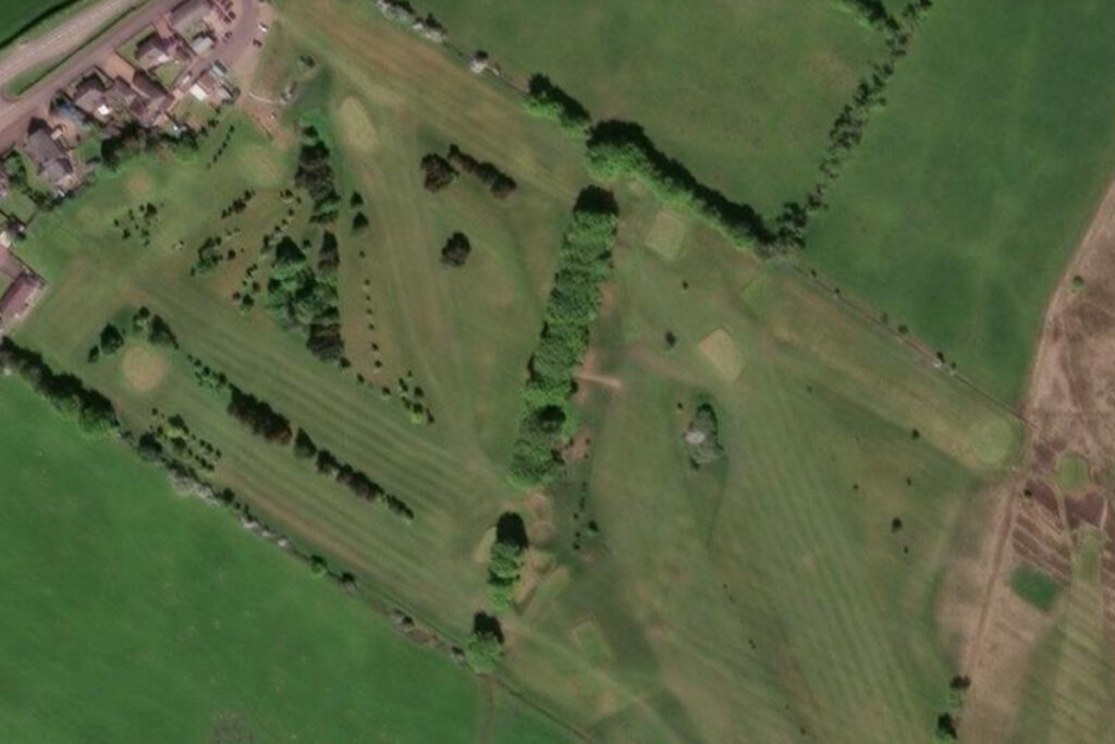
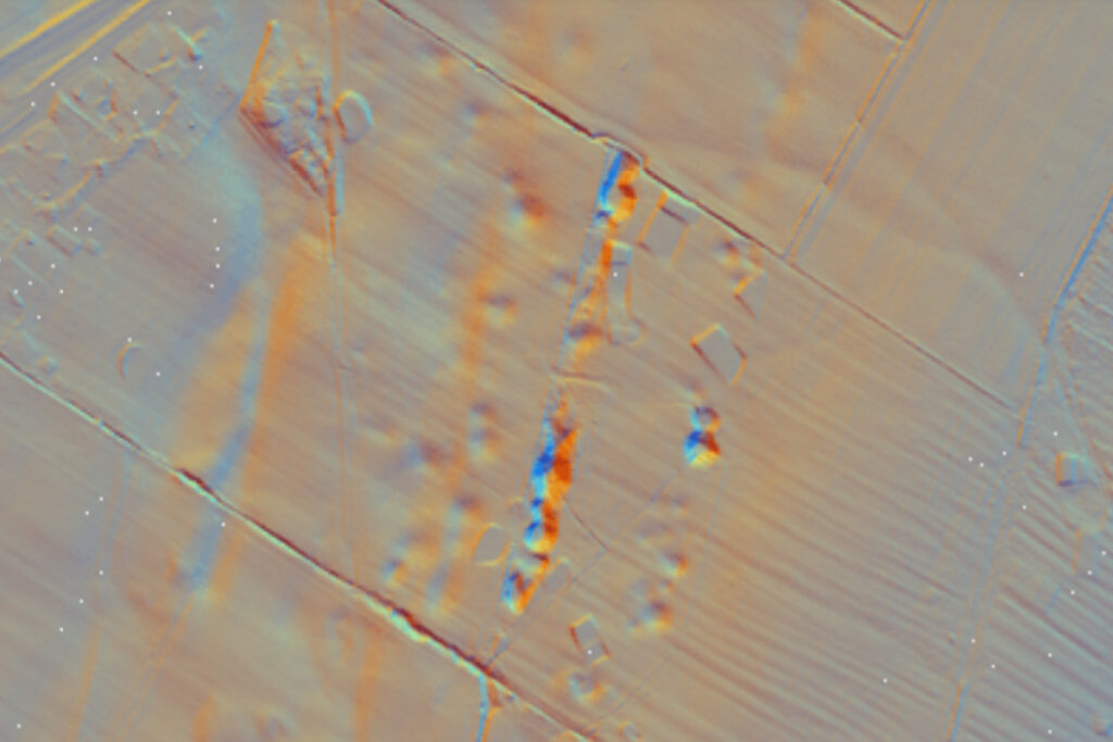
The Ponfeigh Burn cuts a deep valley as it flows down the hillside towards the Douglas Water, conveniently revealing the succession of coal seams. In early days coal was dug out where uncovered by the burn, and mines were driven into the sides of the valley. Early miners also dug coal where seams outcropped at the surface; digging a pit as deep as practical before abandoning the excavation and starting a new one further along the outcrop. These left a line of crop-pits, rather like a string of pearls. Three parallel lines of crop pits remain evident in the humps and hollows of the golf course. All of this excavation will have been carried out with the most basic tools; a pick, shovel, a barrow and perhaps an obliging horse.
This shallow coal was gradually exhausted, and in 1796 Lord Douglas commissioned expert advice on how his coalfields might be developed. His Rigside minerals were leased to Robert Swann early in 19th century (perhaps in 1823) and new shafts were sunk on low lying land close to the Douglas Water. A steam pumping engine was installed to keep the workings free of water, and in 1863 the pits were linked to the railway network. The Swann family (affectionately referred to as the black swans) continued to develop the coal operations and in 1878 a pit was sunk on the east side of the Ayr road, close to the current golf clubhouse. The shaft – known as Rigside Colliery – reached the Skaterigg coal at a depth of 78 metres, and its output was transported by cable-hauled tramway that passed beneath the Ayr road and down the hillside to the mainline railway three quarters of a mile away
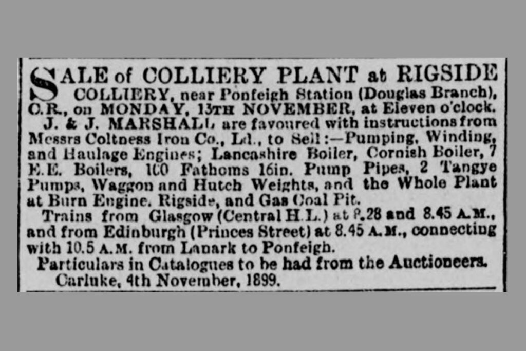
The Swann family (trading as the Rigside Mining Company) relinquished their mineral lease following the death of James Swann, and in about 1893 this was then taken over by the Coltness Iron Company. Plant and machinery at the Swann’s pits, including Rigside Pit, were auctioned off in 1899. The Coltness Company sunk a major new pit in the valley to access the deeper seams of the Douglas coalfield. This new Douglas colliery (sometimes known as Ponfeigh pit) opened in 1898 and continued in production until 1967 when it closed following a fire.
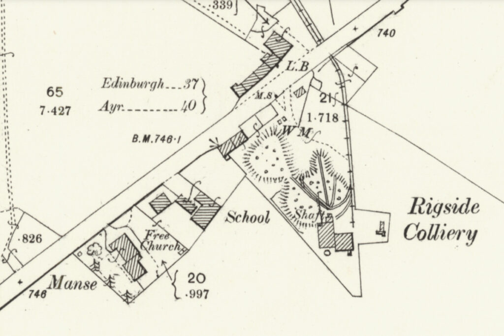
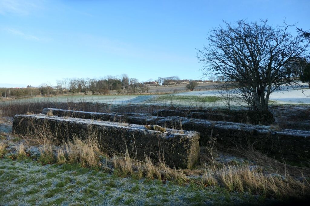
The club house lies close to the site of Rigside colliery. The massive concrete foundations of pithead machinery are still clearly evident.
The derelict land surrounding the Rigside pit, and the earlier crop pits on the hillside above the Ayr Road, were put to good use once the Douglas Water Golf Club was established in 1922. The course was skilfully laid out around the deepest of the crop pits, while other workings were partly infilled. The massive concrete foundations of the winding and haulage engines of Rigside Colliery still protrude from the undergrowth near the club house, while across the Ayr Road, the straight course of the road to the concrete plant marks the route of the haulage.
Ground staff do a wonderful job in keeping the course in top condition, and it may be imagined that continued settlement of the ground requires continuous attention to drainage and the level of the greens. The golf course remains a fantastic community resource, both for those who play, and those who enjoy a little exercise and some fine views. The strings of ancient humps and hollows also serve as a memorial to those who earned a living from the land’s mineral riches, more than two centuries ago.
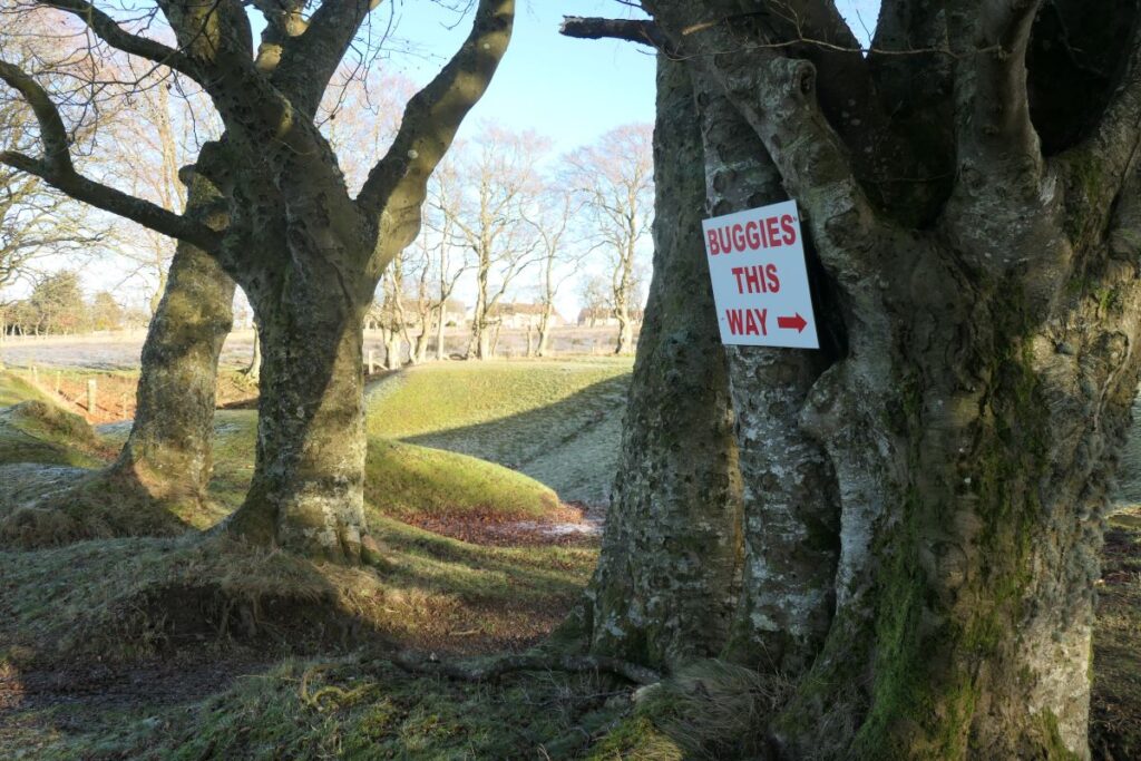
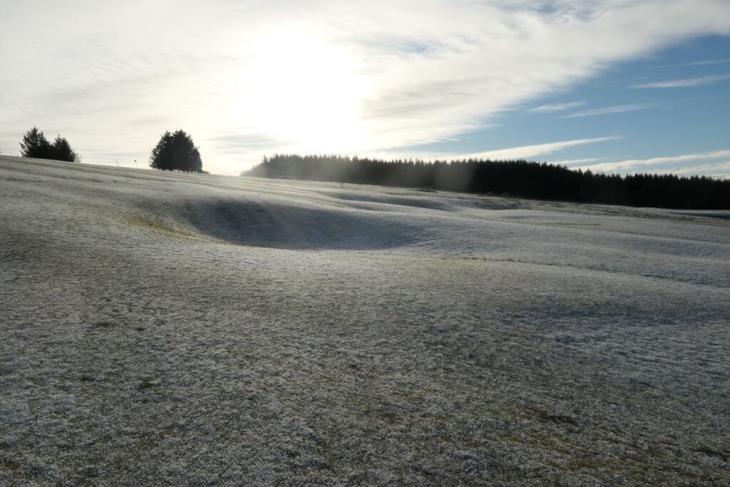
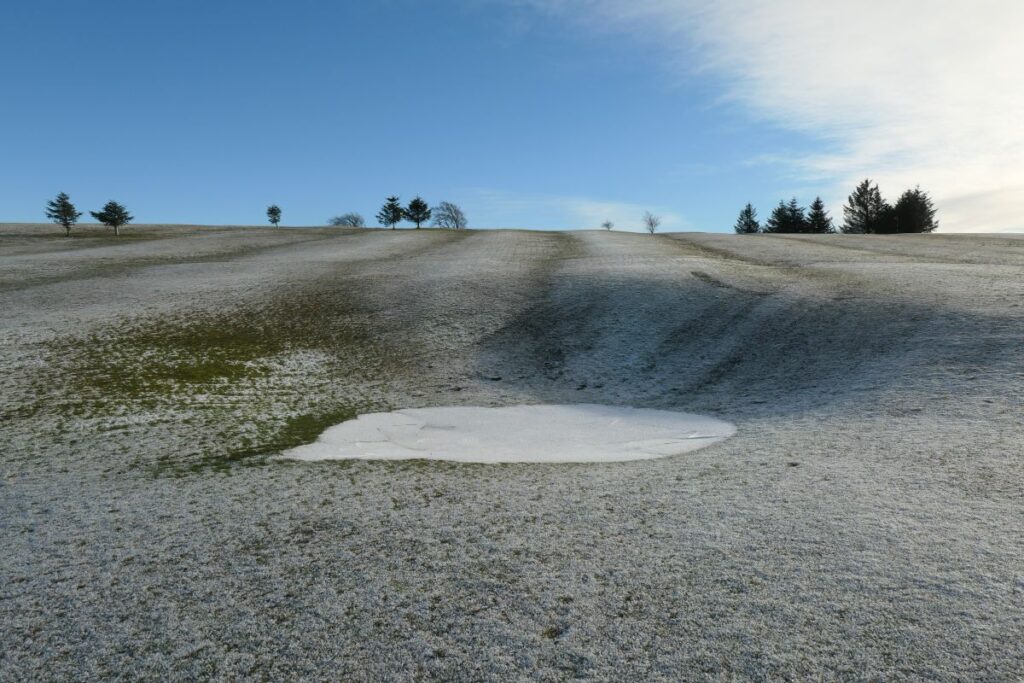
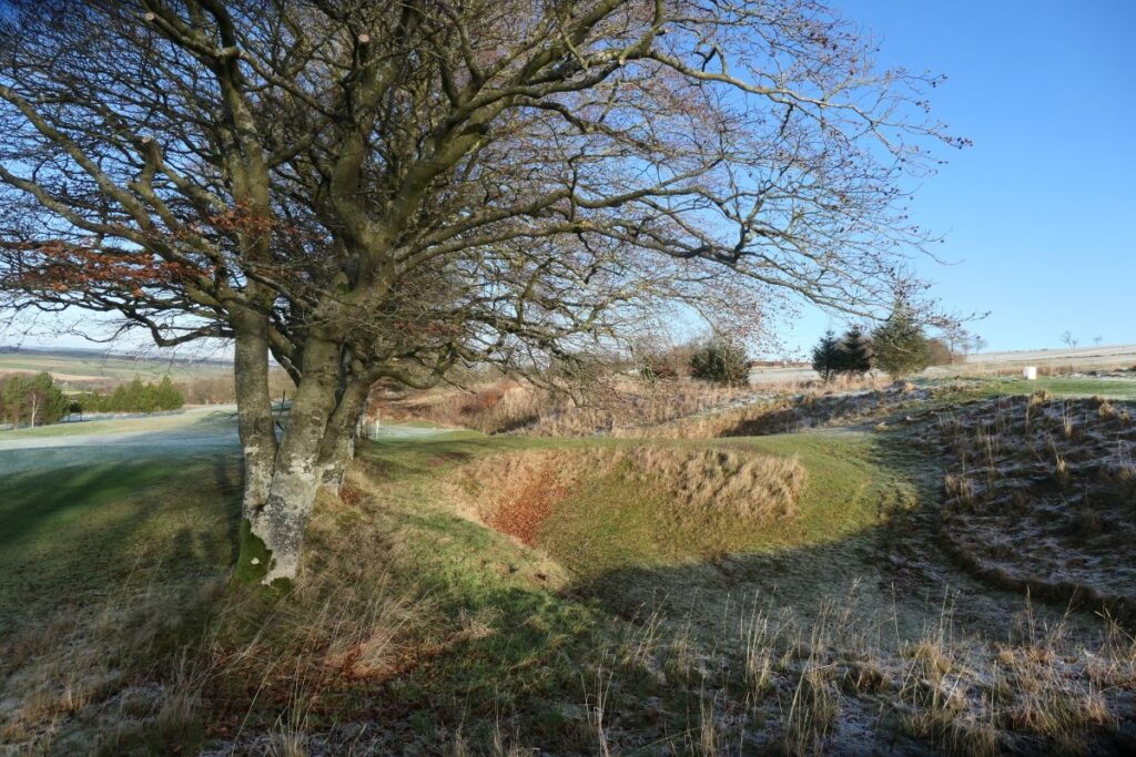
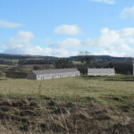
Humps and hollows on the golf course, marking the line of crop pit that cross the area
Robin Chesters, 9th January 2025
Unless otherwise stated, all text, images, and other media content are protected under copyright. If you wish to share any content featured on Clydesdale's Heritage, please get in touch to request permission.