

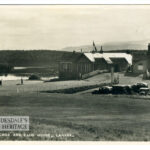
Wood Town Atlas
Year: 1822
This map is from the Wood Town Atlas of 1822. At this point, Lanark had not changed much since the Middle Ages.
The Castle is at the bottom of the Castlegate/Broomgate area, the main street facing St Nicholas was the High Street, the Broomgate was the area where the Grey Friars was located and down the Wellgate, one had a considerable walk to the old St Kentigerns.
Unless otherwise stated, all text, images, and other media content are protected under copyright. If you wish to share any content featured on Clydesdale's Heritage, please get in touch to request permission.

Area
Tags
Subscribe
Login
0 Comments
Oldest