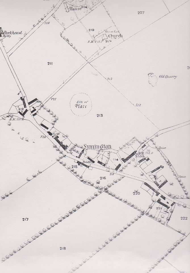
Ordinance Map of Symington
Year: 1864
The first edition of the 1864 Ordinance Map of Symington, showing a site simply called ‘The Place’. This was likely a medieval castle or fortification, though limited information is known about this.
Unless otherwise stated, all text, images, and other media content are protected under copyright. If you wish to share any content featured on Clydesdale's Heritage, please get in touch to request permission.


This ancient site may be called “Castlehill”. There is no signage but there is a footgate from Burnhead Road and a walking path that appears to lead toward ‘the castle’.