

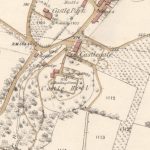
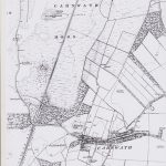
Ordnance Survey map of Lanark
Year: 1860
This Ordnance Survey map shows Lanark in the 1860s.
Map reproduced courtesy of the National Library of Scotland.
Unless otherwise stated, all text, images, and other media content are protected under copyright. If you wish to share any content featured on Clydesdale's Heritage, please get in touch to request permission.
Area
Tags
Subscribe
Login
0 Comments
Oldest