
Tag: Ordnance Survey
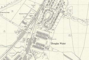
Ordnance Survey map of Ponfeigh Station
mapAn Ordnance Survey map from c. 1950 showing the location of Ponfeigh Station relative to the Douglas Water community. Ponfeigh Railway Station operated between 1864 and 1964 on the Douglas…
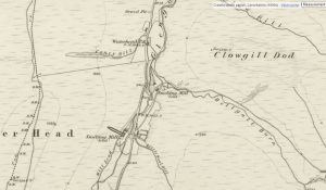
First Edition Ordnance Survey map of Leadhills
mapThis is the first Ordnance Survey map of Leadhills from 1859. The OS maps were a game-changer in the field of cartography. From this map, we see that many of…
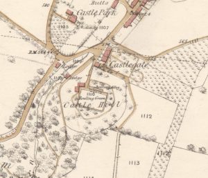
Ordnance Survey map of Lanark Castle
mapThis Ordnance Survey map provides some idea of the layout of Lanark Castle.
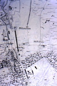
Ordnance Survey map of Wilsontown
mapThe updated Ordnance Survey map of Wilsontown from 1898 shows the profound effect that railways had on industrial areas such as Wilsontown. The station was near Wilsontown House. The term…
First Ordnance Survey map of Wilsontown
mapOne of the first Ordnance Survey maps of Wilsontown and the surrounding area. The map shows the Iron Works as being disused. Parallel to the old iron works is a…
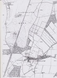
Ordnance Survey map of Carnwath
mapOne of the first Ordnance Survey maps of Carnwath, from c. 1860. Several interesting features are included, such as the Lockhart Arms Hotel, which is now a farm. The original…
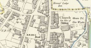
Ordnance Survey map of Lesmahagow
mapAn example of a 25″ to 1 mile map of Lesmahagow completed in 1896 for the Ordnance Survey. Interesting notes include the Gas Works located next to the graveyard. The…
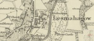
First Ordnance Survey map of Lesmahagow
mapThe first Ordnance Survey 6″ to 1 mile map of the Lesmahagow area shows a major change in map making. By 1864, the detail included in the maps is considerable.…
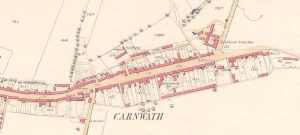
25″ Ordnance Survey map of Carnwath
mapA 25″ Ordnance Survey (OS) map of Carnwath from 1858. The map shows the position of the Lockhart Arms Inn, which is now a farm. The tavern was one of…
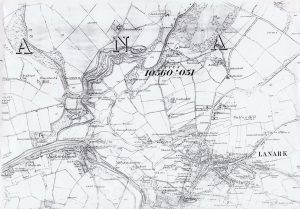
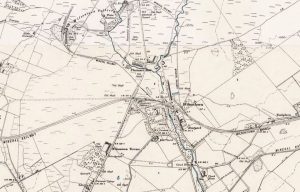
Ordnance Survey map of Lanark
mapThis Ordnance Survey map shows Lanark in the 1860s. Map reproduced courtesy of the National Library of Scotland.