
![]()
Welcome to Clydesdale's Heritage, a project aimed at encouraging all people to take an active interest in the heritage and history of the Clydesdale area.
This website is one of several initiatives from Lanark and District Archaeology Society (LADAS) to encourage engagement with the history of the region.
The project includes lecture programmes, fieldwalks, cataloguing artefacts, inspiring school pupils during talks and presentations, and working with like-minded organisations – with the end goal being to record and preserve the heritage of Clydesdale.
Most popular this month
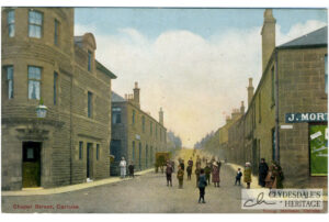
Chapel St. Carluke
postcardColoured printed postcard, Reliable series, not postally used. CH25.0063
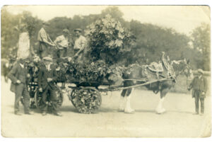
The Village Blacksmith
postcardPhotographic postcard, perhaps illustrating Lamington, posted 29th August 1917, CH25.0062
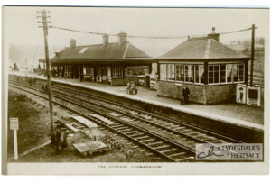
The Station, Lesmahagow
postcardPhotographic postcard, published by J. Davidson, Lesmahagow, not postally used. CH25.0075
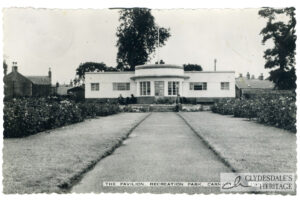
The Pavilion, Carnwath
postcardPhotographic postcard, published by Dalling & Henderson, posted 14th July 1972. CH25.0073
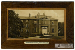
Newton, Elvanfoot
postcardColoured printed postcard, published by J. Brown, Post Office, Elvanfoot, postmarked 28th June 1909. CH25.0071
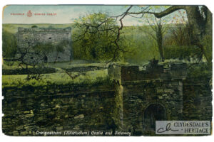
Craignethan (Tillitudlem) Castle
postcardColoured printed postcard. Reliable series, not postally used, CH25.0070
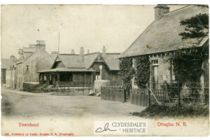
Townhead, Douglas
postcardPrinted postcard published by Lamb, Douglas No. 823. Postmarked 7th January 1912. CH25.0069