![]()
Welcome to Clydesdale's Heritage, a project aimed at encouraging all people to take an active interest in the heritage and history of the Clydesdale area.
This website is one of several initiatives from Lanark and District Archaeology Society (LADAS) to encourage engagement with the history of the region.
The project includes lecture programmes, fieldwalks, cataloguing artefacts, inspiring school pupils during talks and presentations, and working with like-minded organisations – with the end goal being to record and preserve the heritage of Clydesdale.
Most popular this month

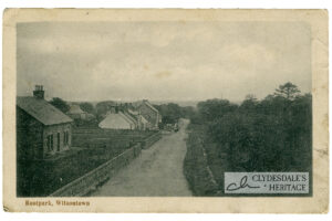
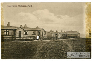
Root Park, Wilsontown
postcardSepia postcard, published by Robert Ross, Forth. Not postally used. CH25.0051
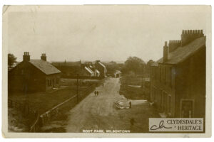
Root Park, Wilsontown
postcardSepia printed postcard, published by Robert Ross, Forth. Not postally used. CH25.0048
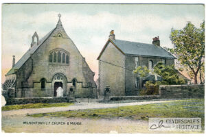
Wilsontown U.F. Church & Manse
postcardColoured printed postcard, published by Robert Ross, Forth. Not postally used. CH25.0047
Building the Sandilands Viaduct.
articleThe “Six Arches” railway bridge across the Clyde near Boathaugh was once a familiar sight to those travelling towards Douglas along the A70, and added a little excitement to the…
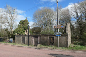
The Toll House at Hyndford Bridge.
articleEvery day, thousands of vehicles drive past the sad little toll house on the south side of Hyndford bridge, paying little attention. The roof of the building collapsed earlier this…
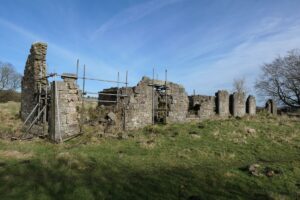
Greenbank and the Ghost Village of Haywood
articleThe ruined grocery store at Greenbank overlooks a wild expanse of featureless moorland. You reach it along a grassy track that winds up a slope past a series of ridges…