
![]()
Welcome to Clydesdale's Heritage, a project aimed at encouraging all people to take an active interest in the heritage and history of the Clydesdale area.
This website is one of several initiatives from Lanark and District Archaeology Society (LADAS) to encourage engagement with the history of the region.
The project includes lecture programmes, fieldwalks, cataloguing artefacts, inspiring school pupils during talks and presentations, and working with like-minded organisations – with the end goal being to record and preserve the heritage of Clydesdale.
Most popular this month
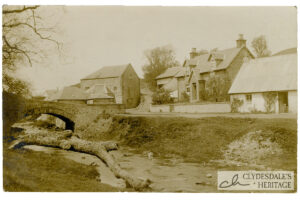
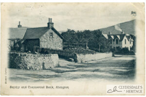
Smithy and Bank, Abington
postcardPrinted postcard, Brown’s series, postmarked August 6th 1906. CH25.0061
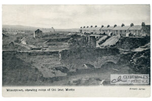
Wilsontown Iron Works Ruins
postcardPrinted postcard, Brown’s Series published by J.T. Smith, Forth. Postally unused CH25.0059
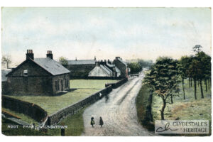
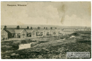
Root Park, Wilsontown
postcardColoured printed postcard, Albany Series 4015. Postmarked 1907. CH25.0058
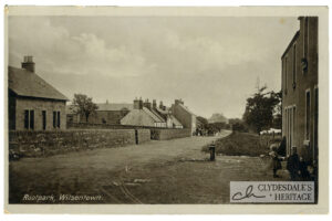
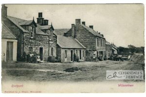
Rootpark, Wilsontown
postcardPrinted postcard published by Scott, post office, Forth No 1028. Not postally used. CH25.0057
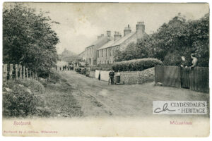
Rootpark, Wilsontown
postcardPrinted postcard published by J. Gibson, Wilsontown, postmarked 15th September 1912. CH25.0054
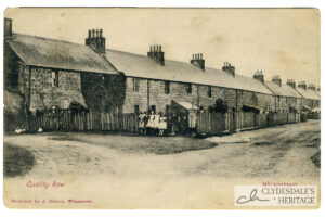
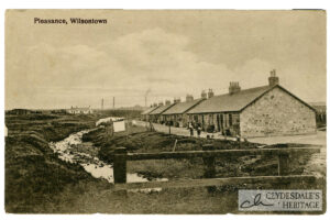
Quality Row, Wilsontown
postcardPrinted postcard, published by J. Scott, Post Office, Forth, postmarked 18th July 1926, CH25.0055
Rootpark, Wilsontown
postcardPrinted postcard, published by J. Gibson, Wilsontown. Postmarked obscured. CH25.0052