
Tag: Ross Map
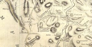
Ross Map of Leadhills
mapA fascinating map of Leadhills from 1776. The map references the “Great Quantities of Gold found here”, as well as areas rich in lead deposits.
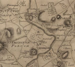
Ross Map of Quothquan
mapThe Ross Map of Quothquan from 1773. The map shows clearly the settlement of Quothquan stretching alongside a road from Roadhead Farm. The church is not marked on this map;…
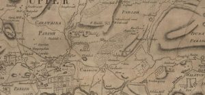
Ross Map of Carnwath
mapA Ross Map of Carnwath dating from 1773. The map includes great detail of Carnwath, including street layouts. It is interesting to note that ‘Cowdayly’ is included in this map.…
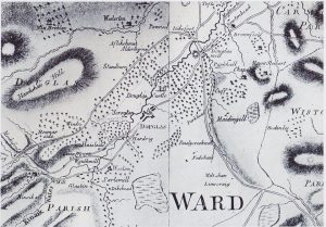
Ross Map of Lanarkshire
mapThe Ross Map of Lanarkshire, dating from 1772. By this time, the last Douglas Castle had been built. On the map is Douglas Mill. It is here that Bonnie Prince…