
Maps
Narrow by year:
Narrow by location:
Narrow by tag:

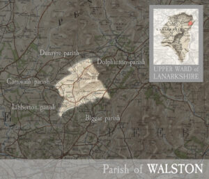
Parish of Walston
mapincluding the villages of Walston and Elsrickle. MAP & INDEX of all parishes. WALSTON, parish immediately northwest of Dolphinton, and averagely 5 miles north-north-east of Biggar, Lanarkshire. Its post town…
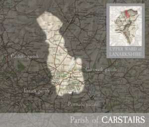
Parish of Carstairs
mapincluding the village of Carstairs the village of Ravenstruther, and most of Carstairs Junction . MAP & INDEX of all parishes. CARSTAIRS, village and parish in upper ward of Lanarkshire.…
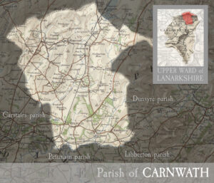
Parish of Carnwath
mapincluding the village of Carnwath and the villages of Auchengray, Braehead, Climpy, Forth, Haywood, Kaimend, Kersewell, Newbigging, Tarbrax, Woolfoods, West End, Wilsontown, and part of Carstairs Junction. MAP & INDEX…
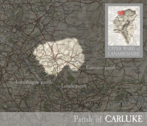
Parish of Carluke
mapincluding the town of Carluke and villages of Braidwood, Kilncadzow, Law, and Yieldshields. MAP & INDEX of all parishes. CARLUKE, town and parish in upper ward of Lanarkshire. The town…
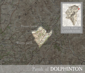
Parish of Dolphinton
mapincluding the village of Dolphinton. MAP & INDEX of all parishes. DOLPHINTON, hamlet and parish on south-east border of Lanarkshire. The hamlet lies 11¼ miles south-east of Carstairs Junction, and…
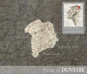
Parish of Dunsyre
mapincluding the village of Dunsyre. MAP & INDEX of all parishes. DUNSYRE, village and parish in upper ward of Lanarkshire. The village stands 6½ miles east of Carnwath, and has…
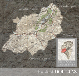
Parish of Douglas
mapincluding the town of Douglas and the village of Glespin and part of Rigside. MAP & INDEX of all parishes. DOUGLAS, river, town, castle, and parish in upper ward of…
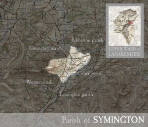
Parish of Symington
mapincluding the village of Symington. MAP & INDEX of all parishes. SYMINGTON, village and parish in upper ward of Lanarkshire. The village stands adjacent to the Clyde, 7 miles south-east…
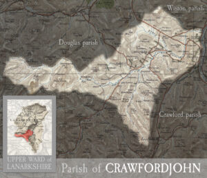
Parish of Crawfordjohn
mapincluding the villages of Abington and Crawfordjohn MAP & INDEX of all parishes. CRAWFORDJOHN, village and parish in upper ward of Lanarkshire. The village stands on Duncaton rivulet, 3¾ miles…