
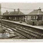
")
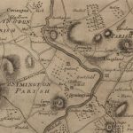
Ross Map of Lesmahagow
Year: 1773
The Ross Map of Lesmahagow from 1773. The detail in the map does not quite match that of Roys’ map, but it does show some of the dwellings and farms surrounding Lesmahagow.
Map courtesy of the National Library of Scotland.
Unless otherwise stated, all text, images, and other media content are protected under copyright. If you wish to share any content featured on Clydesdale's Heritage, please get in touch to request permission.
Area
Tags
Subscribe
Login
0 Comments
Oldest