
Year: 1816
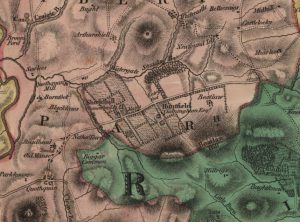
Forest Map of Shieldhill
mapThe Forest Map of 1816 showing Shieldhill contains considerably more detail than William Roy’s map of 1752. The map indicates the growing importance of neighbouring Huntfield. The Chancellors had continued…
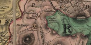
Forest Map of Quothquan
mapThe Forest Map of Quothquan from 1816. This map shows Roadhead as a farm, and also shows that the Manse lay in a field to the west of the ruins…