
")
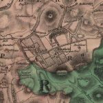
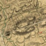
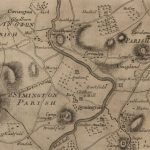
Forest Map of Quothquan
Year: 1816
The Forest Map of Quothquan from 1816.
This map shows Roadhead as a farm, and also shows that the Manse lay in a field to the west of the ruins of the church. It refers to a tomb, presumably that of the Chancellor family.
Quothquan of today is located at Nethertown, but in Forest’s day, it seems to have been located elsewhere.
Map courtesy of the National Library of Scotland.
Unless otherwise stated, all text, images, and other media content are protected under copyright. If you wish to share any content featured on Clydesdale's Heritage, please get in touch to request permission.
Area
Tags
Subscribe
Login
0 Comments
Oldest