Year: 1896
Ordnance Survey map of Lesmahagow
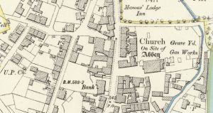
mapAn example of a 25″ to 1 mile map of Lesmahagow completed in 1896 for the Ordnance Survey. Interesting notes include the Gas Works located next to the graveyard. The…
More results...

An example of a 25″ to 1 mile map of Lesmahagow completed in 1896 for the Ordnance Survey. Interesting notes include the Gas Works located next to the graveyard. The…