
Tag: Caledonian Railway Company
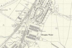
Ordnance Survey map of Ponfeigh Station
mapAn Ordnance Survey map from c. 1950 showing the location of Ponfeigh Station relative to the Douglas Water community. Ponfeigh Railway Station operated between 1864 and 1964 on the Douglas…
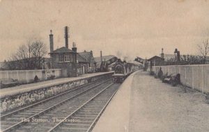
The Station at Thankerton
postcardThis is a great card showing the facilities at Thankerton Railway Station that included a goods yard plus a place to put water in a train’s boiler. Also, there is…
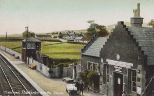
Townhead, Thankerton from the station
postcardThis is a nice view of the Station building at Thankerton with the adjacent signal box. The card dates to about 1905. Notice the advert for the Central Station Hotel…
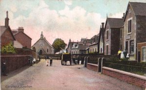
Strawfrank Church
postcardThis is a view of Carstairs Junction of Strawfrank Church looking South. This Church was in part funded by the railway workers employed by the Caledonian Railway Company. Carstairs Junction,…
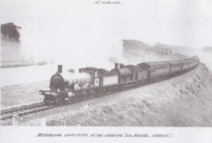
Sandilands Viaduct to Douglas
postcardThis is a special train that has just crossed the Sandilands Viaduct going to Douglas and Muirkirk. The picture was taken on 30th June 1963. In the following year October…