
Tag: Nethan
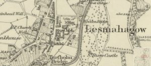
First Ordnance Survey map of Lesmahagow
mapThe first Ordnance Survey 6″ to 1 mile map of the Lesmahagow area shows a major change in map making. By 1864, the detail included in the maps is considerable.…
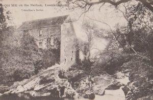
Old Mill, Nethan
postcardThis is a view of the Old Mill on the Nethan, Lesmahagow, which lies underneath the modern M74 motorway. Plans commenced in the 1980s to restore the Old Mill, but…