
Year: 1596

Pont Map of Crawford
mapThe castle at Crawford, shown in this map from c. 1596, made a great impression on the cartographer, Timothy Pont. The castle had been owned by the Lindsay family since…
Pont map of Couthally
mapPont’s 1596 map of Couthally. Couthally Castle, near Carnwath, was more important than Carnwath as it was then the home of the Sommerville’s. Later, the estate passed into the hands…
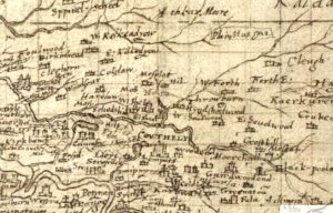
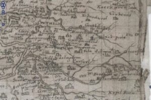
Pont Map of Carnwath
mapAn amazingly detailed map of the Carnwath area by cartographer Timothy Pont in c. 1596. It is fascinating to see both a West and East Kilncadzow mentioned. Map courtesy of…
Pont Map of Biggar
mapAn interesting map of Biggar by cartographer Timothy Pont in c. 1596. St Mary’s Church can be seen on the map. Curiously, there are two castles indicated – one showing…
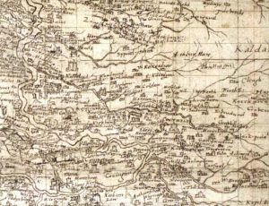
Pont Map of Leadhills area
mapIn 1596, when this map was produced, lead mining had not commenced in the area. As such, the map shows a number of small settlements such as Glendorch and Snar.…
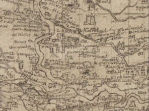
Pont’s Map of Lanark
mapPont’s Map of Lanark from 1596. This map gives an incredible look at the layout of Lanark during the time of James VI of Scotland. By 1596, Lanark had four…
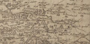
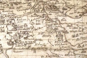
Pont map of Carnwath
mapThis is the Timothy Pont map of Carnwath from 1596. It later formed the basis of the map created by Joan Blaeu of the Netherlands. The map does not mention…
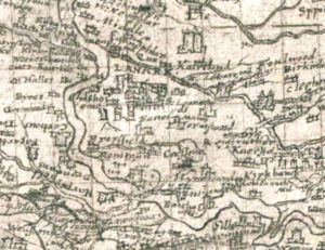
Pont Map of Lanark
mapA Timothy Pont map from 1596 showing Lanark. The map shows what appears to be a tower house enclosed by a ditch. This ditch could be the remains of the…
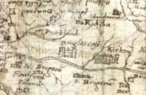
Pont Map, Douglas Castle
mapThis picture from Pont shows how Douglas Castle may have looked in 1596 when the map for Lanarkshire was created. The late Professor McClean from Dundee thought that Pont Map…
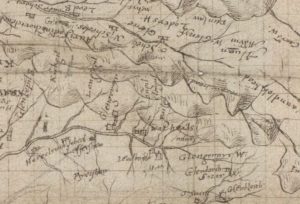
Auchengray and Tarbrax
mapThe maps relate to Tarbrax and Auchengray and cover the period from 1596 when Timothy Pont’s Map was completed till Thomson’s map of Lanarkshire in 1832. The maps used in…