
")
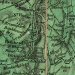
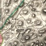
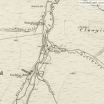
Forrest map of Leadhills
Year: 1819
The Forrest map of Leadhills from 1819. This map includes various details, including reference to the Hopetouns. The Hopetouns had owned the land around Leadhills since the early part of the 17th century.
Map courtesy of the National Library of Scotland.
Unless otherwise stated, all text, images, and other media content are protected under copyright. If you wish to share any content featured on Clydesdale's Heritage, please get in touch to request permission.
Area
Tags
Subscribe
Login
0 Comments
Oldest