
Maps
Narrow by year:
Narrow by location:
Narrow by tag:
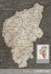
Parish of Crawford
mapincluding the villages of Crawford and Leadhills. MAP & INDEX of all parishes. CRAWFORD, village and parish in southern extremity of Lanarkshire. The village stands on the Clyde, 2 miles…

Parish of Lesmahagow
mapincluding the town of Lesmahagow, and the villages of Auchenheath, Blackwood, Boghead, Coalburn, Crossford, Hazelbank, Kirkfieldbank, Kirkmuirhill, New Trow, and Turfholm. MAP & INDEX of all parishes. LESMAHAGOW, town and…
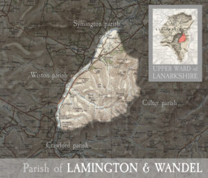
Parish of Lamington & Wandel
mapincluding the villages of Lamington and Wandel. MAP & INDEX of all parishes. LAMINGTON, village and parish in upper ward of Lanarkshire. The village stands on burn of its own…
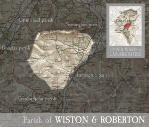
Parish of Wiston & Roberton
mapincluding the villages of Wiston and Roberton. MAP & INDEX of all parishes. WISTON, village and parish in upper ward of Lanarkshire. The village stands about a mile west-north-west of…
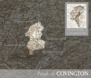
Parish of Covington
mapincluding the villages of Covington and Thankerton. MAP & INDEX of all parishes. COVINGTON, village and parish in upper ward of Lanarkshire. The village stands about 1¼ mile north of…
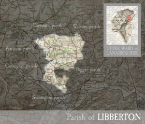
Parish of Libberton
mapincluding the villages of Libberton and Quothquan. MAP & INDEX of all parishes. LIBBERTON, hamlet and parish in upper ward of Lanarkshire. The hamlet lies 2½ miles south-east of Carnwath,…
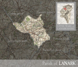
Parish of Lanark
mapincluding the Royal Burgh of Lanark and the villages of Cartland, Cleghorn, Hyndfordbridge, Nemphlar, and New Lanark. MAP & INDEX of all parishes. LANARK, town and parish in upper ward…
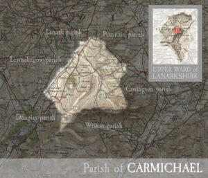
Parish of Carmichael
mapincluding the villages of Carmichael, Douglas Water, Ponfeigh, and parts of Rigside. MAP & INDEX of all parishes. CARMICHAEL, parish in upper ward of Lanarkshire. Its post town in Thankerton.…
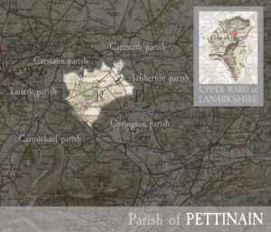
Parish of Pettinain
mapincluding the village of Pettinain. MAP & INDEX of all parishes. PETTINAIN – hamlet and parish in the upper ward of Lanarkshire. The hamlet lies near the Clyde, 5| miles…
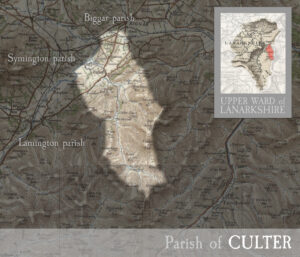
Parish of Culter
mapincluding the village of Culter (or Coulter). MAP & INDEX of all parishes. CULTER, village in upper ward of Lanarkshire, and parish partly also in Peebleshire. The village stands on…