
Maps
Narrow by year:
Narrow by location:
Narrow by tag:
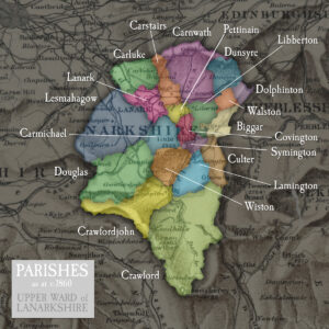
Index of parishes in the upper ward of Lanarkshire
mapThroughout most of the 19th century, the upper ward of Lanarkshire comprised of twenty parishes. Follow these links to explore stories and records from each parish:
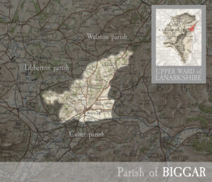
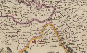
Parish of Biggar
mapincluding the town of Biggar, and village of Candy Mill. MAP & INDEX of all parishes. BIGGAR, rivulet of Lanarkshire and Peeblesshire, and town and parish on south-east border of…

Thomson Map of Pettinain
mapThomson’s map of Pettinain, from 1832, has great detail, pinpointing more accurately Eastshield and the Grange. John Thomson (1777-c1840) was a Scottish cartographer from Edinburgh, celebrated for his 1817 New…
Blaeu map of Pettinain
mapThis map, by Joan Blaeu in 1654, shows Pettinain – described on the map as ‘Petynan’. Nearby is the Grange – the grange is mentioned in the records of the…
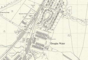
Ordnance Survey map of Ponfeigh Station
mapAn Ordnance Survey map from c. 1950 showing the location of Ponfeigh Station relative to the Douglas Water community. Ponfeigh Railway Station operated between 1864 and 1964 on the Douglas…
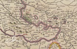
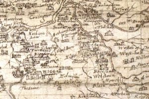
Blaeu map of Biggar
mapThis is another section of the Clydesdale Map – this section was called the Upper Ward. Some interesting bits around Biggar include West and East Hartree represented by towers. Shieldhill…

Pont Map of Crawford
mapThe castle at Crawford, shown in this map from c. 1596, made a great impression on the cartographer, Timothy Pont. The castle had been owned by the Lindsay family since…
Pont map of Couthally
mapPont’s 1596 map of Couthally. Couthally Castle, near Carnwath, was more important than Carnwath as it was then the home of the Sommerville’s. Later, the estate passed into the hands…
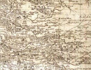
Pont Map of Carnwath
mapAn amazingly detailed map of the Carnwath area by cartographer Timothy Pont in c. 1596. It is fascinating to see both a West and East Kilncadzow mentioned. Map courtesy of…
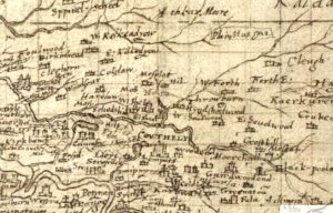
Pont Map of Biggar
mapAn interesting map of Biggar by cartographer Timothy Pont in c. 1596. St Mary’s Church can be seen on the map. Curiously, there are two castles indicated – one showing…