
Year: 1832

Thomson Map of Pettinain
mapThomson’s map of Pettinain, from 1832, has great detail, pinpointing more accurately Eastshield and the Grange. John Thomson (1777-c1840) was a Scottish cartographer from Edinburgh, celebrated for his 1817 New…
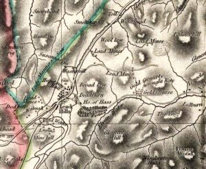
Thomson Map of Leadhills
mapThis is a valuable map of Leadhills from 1832. The map shows the horse gin (marked as ‘gin’ on the map) near the village. This apparatus was used to raise…
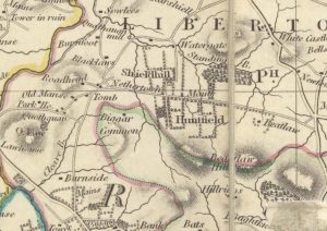
Thomsons Map of Nethertown
mapThomson map of Netherton and surrounding areas from 1832. The map shows more detail than Forest’s map of 1816, particularly in respect of roads. It also shows that Netherton had…
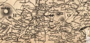
Thomson Map of Lesmahagow
mapThe Thomson Map of Lesmahagow from 1832. The map shows interesting features such as Goldrig, a castle in ruines near Dumbraxhill, and other interesting features such as lint mills and…
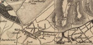
Thomson Map of Carnwath
mapA detailed Thomson Map of Carnwath dating from 1832. Couthally is featured here, though with a slight mis-spelling. Details include the Mansion House (Carnwath House), plus the Kirk and the…
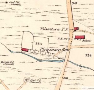
Wilsontown 25 Inch Map
mapThe 25 inch map, which was Thomson’s Map of 1832, shows the Wilsontown area prior to the arrival of the railway. The rail road mentioned on the map was a…