
Year: 1898
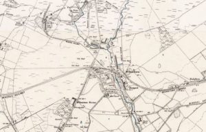
Ordnance Survey map of Wilsontown
mapThe updated Ordnance Survey map of Wilsontown from 1898 shows the profound effect that railways had on industrial areas such as Wilsontown. The station was near Wilsontown House. The term…
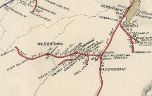
Railway Map showing coal pits
mapA railway map from 1898. This shows just how many coal pits were in production, not to mention the Auchengray Brickworks and the Tarbrax Oil Works. Forth and the surrounding…
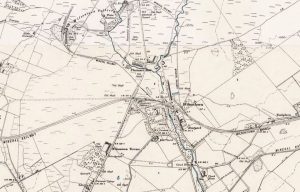
Ordnance Survey, Wilsontown
mapThis Ordnance Survey map of 1898 shows the profound impact that railways had on an industrial area such as Wilsontown. The station was near Wilsontown House. It still survives but…