

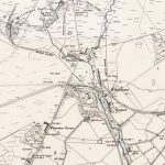
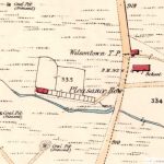
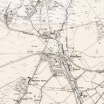
Railway Map showing coal pits
Year: 1898
A railway map from 1898.
This shows just how many coal pits were in production, not to mention the Auchengray Brickworks and the Tarbrax Oil Works. Forth and the surrounding areas were both hubs of industrial activity at the time.
Unless otherwise stated, all text, images, and other media content are protected under copyright. If you wish to share any content featured on Clydesdale's Heritage, please get in touch to request permission.
Area
Tags
Subscribe
Login
0 Comments
Oldest