
Tag: crawford

Main Road, Crawford
postcardColoured postcard, published by Robert Murray, Post Office, Crawford. Postmark undecipherable. CH25.0009

Pont Map of Crawford
mapThe castle at Crawford, shown in this map from c. 1596, made a great impression on the cartographer, Timothy Pont. The castle had been owned by the Lindsay family since…
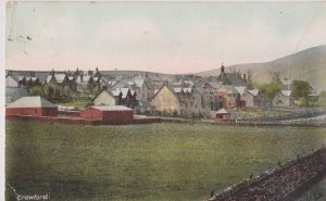
Free Church of Crawford
postcardThis is a view showing the Free Church of Crawford in the background. The houses are predominately late nineteenth century. Some houses near the Colebrooke Arms are much earlier and…
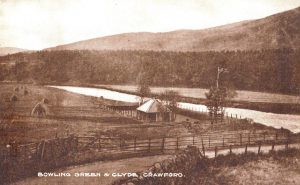
Bowling Green and Clyde
postcardThis was produced by the local post office for a man called Murray. It shows Crawford Bowling Green. The Bowling Club stood here till 1950, when it was moved to…