
Tag: Joan Blaeu
Blaeu map of Pettinain
mapThis map, by Joan Blaeu in 1654, shows Pettinain – described on the map as ‘Petynan’. Nearby is the Grange – the grange is mentioned in the records of the…
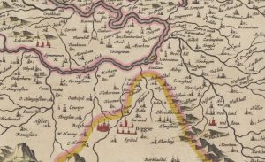
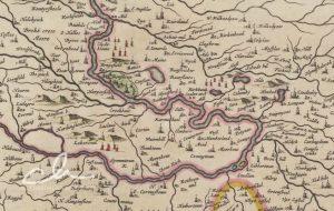
Blaeu map of Biggar
mapThis is another section of the Clydesdale Map – this section was called the Upper Ward. Some interesting bits around Biggar include West and East Hartree represented by towers. Shieldhill…
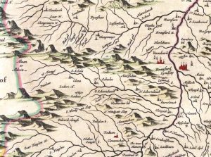
Blaeu map of Leadhills
mapBlaeu’s map of Leadhills from 1654. This map greatly improved accuracy from Timothy Pont’s map of the area. Blaeu was a Dutch cartographer born in Alkmaar. This map was produced…
Blaeu map of Quothquan
mapThe 1654 map of Quothquan by Joan Blaeu. The map does not indicate a settlement at Quothquan, instead showing Quothquan Mill (then named ‘Kothoon Mill’). This was shown at a…
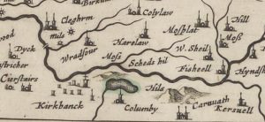
Blaeu map of Columbie
mapA Blaeu map of Columbie (Carstairs), completed by Joan Blaeu in the mid-17th century. The map references Columbie instead of Carstairs. Later maps of the area show Columbie Farm. Blaeu…
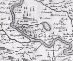
Blaeu map of Couthally
mapA map of Carnwath (Couthally) by Joan Blaeu in 1645. Blaeu was a Dutch cartographer born in Alkmaar, the son of cartographer Willem Blaeu. Couthally rather than Carnwath is mentioned.…
Blaeu map of Bonnington
mapThis map was published in 1654 by Joan Blaeu, a Dutch cartographer born in Alkmaar, the son of cartographer Willem Blaeu. It was based on the first detailed map of…