
Tag: Pettinain

Thomson Map of Pettinain
mapThomson’s map of Pettinain, from 1832, has great detail, pinpointing more accurately Eastshield and the Grange. John Thomson (1777-c1840) was a Scottish cartographer from Edinburgh, celebrated for his 1817 New…
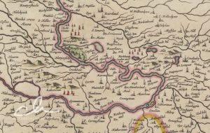
Blaeu map of Pettinain
mapThis map, by Joan Blaeu in 1654, shows Pettinain – described on the map as ‘Petynan’. Nearby is the Grange – the grange is mentioned in the records of the…
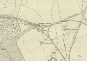
Lampits Ferry
mapThis map of c.1864 shows the position of the Lampits Ferry and how Smiths Bakers van would get to Pettinain. The map also shows the Village of Pettinain, which was…