
Year: 1819
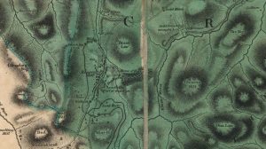
Forrest map of Leadhills
mapThe Forrest map of Leadhills from 1819. This map includes various details, including reference to the Hopetouns. The Hopetouns had owned the land around Leadhills since the early part of…

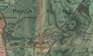
Forest Map of Lesmahagow
mapThe Forest Map of Lesmahagow from 1819. The detail of this map is better and more precise than the Ross Map of Lesmahagow from 1773. The map shows the owners…
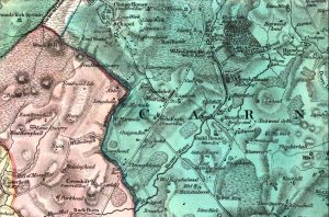
Forest Map of Carnwath
mapA Forest map of Carnwath dating from 1819. The map is detailed, showing the Kirk, manse, mansion house, and Green Inn. It also has the tolls prominently displayed. The money…
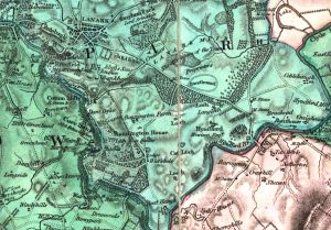
Forest Map showing Bonnington
mapA Forest Map of Lanarkshire from 1819. The Forest Map series showed considerable detail, including of the Bonnington Estate. At this time, walks and paths were created by Lady Mary…
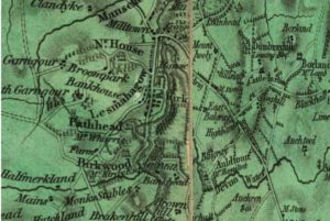
Forest Map
mapA Forest Map from 1819. This is the first detailed map of Lanarkshire to show the Wilsontown Iron Works. It even shows the furnace and a rail road that went…
Forest map
mapA Lesmahagow map from 1819. It is better for detail and is more precise than the Ross Map. It shows too the owners of the principle houses, which is very…