
Tag: Ordnance Survey
Ordnance Survey, Wilsontown
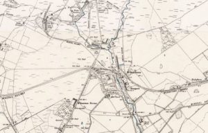
mapThis Ordnance Survey map of 1898 shows the profound impact that railways had on an industrial area such as Wilsontown. The station was near Wilsontown House. It still survives but…

Carnwath 1858 OS Map
mapThis is a very useful map as it shows the position of the Lockhart Arms Inn, now a farm. The tavern was one of the most important in the area.…