
Tag: Coal
Rigside Cannel and the Black Douglas Pit
articleCannel is an unusual form of coal that burns with a brilliant flame if thrown into an open fire; lighting up a room as if by candlelight. Cannel was in…
Extra Holes at Douglas Water
articleAt one time most of the coal used in the upper parishes of Clydesdale, and as far south as Moffat, was carted from pits in Rigside and Ponfeigh. Coal had…
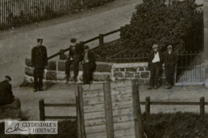
A Prospect of Coalburn
articleThis wonderful and well-known postcard places you at a perfect elevated position from which to observe everyday life in the mining community of Coalburn. Use of a telescopic lens manages…
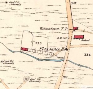
Wilsontown 25 Inch Map
mapThe 25 inch map, which was Thomson’s Map of 1832, shows the Wilsontown area prior to the arrival of the railway. The rail road mentioned on the map was a…
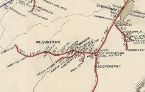
Railway Map showing coal pits
mapA railway map from 1898. This shows just how many coal pits were in production, not to mention the Auchengray Brickworks and the Tarbrax Oil Works. Forth and the surrounding…
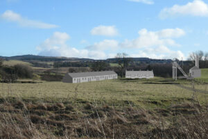
The Story of Wilsontown
articleWilsontown–the birthplace of Scotland’s Industrial Revolution. Wilsontown is not a place known to many people but it is the birthplace of Scotland’s Industrial Revolution. Prior to 1779, when work began…