
Tag: Couthally
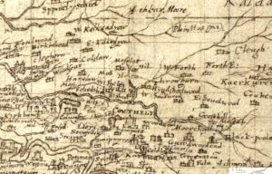
Pont map of Couthally
mapPont’s 1596 map of Couthally. Couthally Castle, near Carnwath, was more important than Carnwath as it was then the home of the Sommerville’s. Later, the estate passed into the hands…
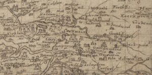
Pont map of Carnwath
mapThis is the Timothy Pont map of Carnwath from 1596. It later formed the basis of the map created by Joan Blaeu of the Netherlands. The map does not mention…
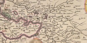
Blaeu map of Couthally
mapA map of Carnwath (Couthally) by Joan Blaeu in 1645. Blaeu was a Dutch cartographer born in Alkmaar, the son of cartographer Willem Blaeu. Couthally rather than Carnwath is mentioned.…
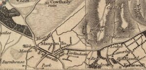
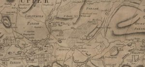
Thomson Map of Carnwath
mapA detailed Thomson Map of Carnwath dating from 1832. Couthally is featured here, though with a slight mis-spelling. Details include the Mansion House (Carnwath House), plus the Kirk and the…
Ross Map of Carnwath
mapA Ross Map of Carnwath dating from 1773. The map includes great detail of Carnwath, including street layouts. It is interesting to note that ‘Cowdayly’ is included in this map.…