
Tag: William Roy
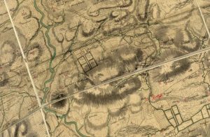
Roy Map of Quothquan and Shieldhill
mapWilliam Roy’s 1752 map of Quothquan and Shieldhill, showing that the area around Shieldhill had several fields surrounded by trees, part of a designated landscape. Quothquan Mill is shown to…
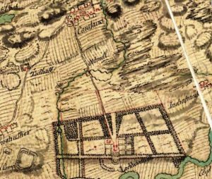
William Roy map of Carstairs
mapThe William Roy map shows the village of Carstairs with properties marked out. Of much interest is Carstairs House, which was – at this point – still occupied by the…
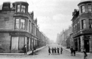
A brief history of Carluke
articleAlthough Carluke is a parish with seemingly ordinary buildings and inhabitants, the stories behind the buildings and the people make the town and parish unique. The origins of Carluke’s name…