
Carnwath
Carnwath has an interesting history going back to the Medieval period when the motte was built by the Sommerville family who came to the area in the twelfth century. This still exists today as a feature in Carnwath Golf course. Field-walking and metal detecting in the area around the Motte have resulted in the recovery of both pottery and coins from the 12th and 13th centuries; the coins being silver pennies of Edward I.
The Sommerville family were also responsible for building a church across the road from the Motte; much of the original Medieval church has disappeared. What is left is the St Mary’s Ailse, which was constructed in 1424. The style of the ailse is similar to the church of Corstophine on the outskirts of Edinburgh and is typical of the Perpendicular style of architecture which was common in England at that time. In the the Ailse there are several monuments to members of the Sommerville family, the Dalzells, and the Lockharts. In the churchyard there many interesting gravestones including one of a knight and a memorial to some of the martyrs of the Covenanting era.
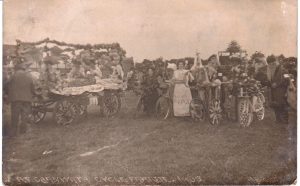
Carnwath had a Medieval tolbooth till the 1930s when it was demolished. This building went back to the early part of the sixteenth century at a time when the famous Red Hose Race started. It began in 1508 and is reputed to be the oldest foot race in Scotland. The tradition was that the local laird had to give a pair of stockings (hose) as a prize or forfeit his lands.
Although Carnwath lost its tolbooth, the records of the barony court of the Burgh of Carnwath survive and were published by the Scottish Record Society; these cover the period of the 1530s–1540s and give a fascinating insight into the story of the farming community in Carnwath and its surroundings
Narrow by year:
Narrow by tags:
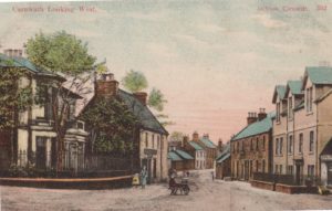
Carnwath Looking West
postcardThis postcard shows the Royal Bank of Scotland (now gone), plus the old Tolbooth. Also pictured is a shop called Ballantynes, though no information is available regarding this shop.
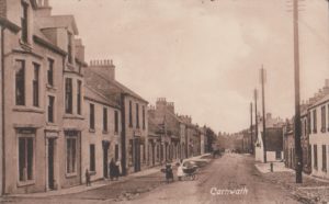
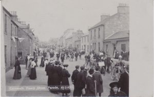
Carnwath towards tolbooth
postcardThis card was sent on 26th November 1916 to Monsieur Fillon in Bayeux, France. The writer is practising their French and saying that Carnwath is lying under a blanket of…

Carnwath 1858 OS Map
mapThis is a very useful map as it shows the position of the Lockhart Arms Inn, now a farm. The tavern was one of the most important in the area.…
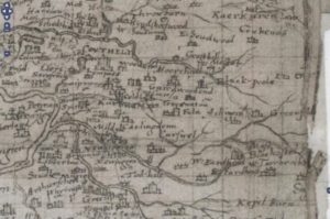
Auchengray and Tarbrax
mapThe maps relate to Tarbrax and Auchengray and cover the period from 1596 when Timothy Pont’s Map was completed till Thomson’s map of Lanarkshire in 1832. The maps used in…
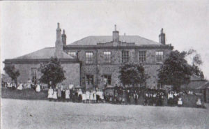
Carnwath Public School article
documentThis article is from Stothers’s, Glasgow, Lanarkshire and Renfrewshire, Christmas and New Year Annual of 1911/1912. The article gives a fascinating insight into the achievements of Carnwath Public School. The…
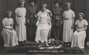
Carnwath & District Old Photos
documentA PowerPoint presentation showing photos from across Carnwath and District across the years. You can download a copy of this presentation in the original format or in a PDF format…
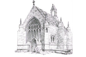
Carnwath Church
articleThe closure of Carnwath Church has prompted me to write a brief history of the Church. The church was built by the architect David Bryce in 1864-7. It was designed to…