
Maps
Narrow by year:
Narrow by location:
Narrow by tag:
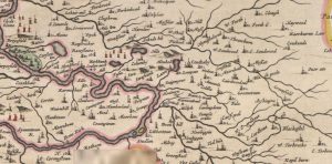
Blaeu map of Couthally
mapA map of Carnwath (Couthally) by Joan Blaeu in 1645. Blaeu was a Dutch cartographer born in Alkmaar, the son of cartographer Willem Blaeu. Couthally rather than Carnwath is mentioned.…
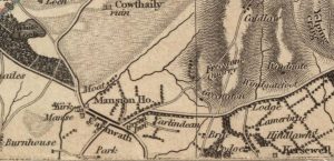
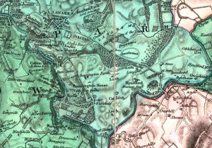
Thomson Map of Carnwath
mapA detailed Thomson Map of Carnwath dating from 1832. Couthally is featured here, though with a slight mis-spelling. Details include the Mansion House (Carnwath House), plus the Kirk and the…
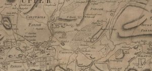
Ross Map of Carnwath
mapA Ross Map of Carnwath dating from 1773. The map includes great detail of Carnwath, including street layouts. It is interesting to note that ‘Cowdayly’ is included in this map.…
Forest Map of Carnwath
mapA Forest map of Carnwath dating from 1819. The map is detailed, showing the Kirk, manse, mansion house, and Green Inn. It also has the tolls prominently displayed. The money…
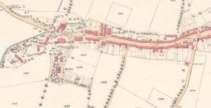
19th century Carnwath map
mapThis was the second map of 1858, showing the whole village of Carnwath. The map indicates three churches in close proximity to each other, including St Mary’s Aisle.
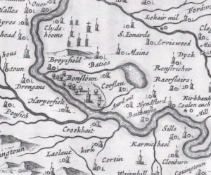
Blaeu map of Bonnington
mapThis map was published in 1654 by Joan Blaeu, a Dutch cartographer born in Alkmaar, the son of cartographer Willem Blaeu. It was based on the first detailed map of…
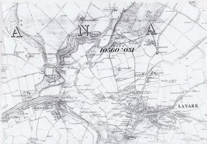
Ordnance Survey map of Lanark
mapThis Ordnance Survey map shows Lanark in the 1860s. Map reproduced courtesy of the National Library of Scotland.
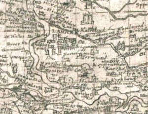
Pont Map of Lanark
mapA Timothy Pont map from 1596 showing Lanark. The map shows what appears to be a tower house enclosed by a ditch. This ditch could be the remains of the…
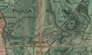
Forest Map showing Bonnington
mapA Forest Map of Lanarkshire from 1819. The Forest Map series showed considerable detail, including of the Bonnington Estate. At this time, walks and paths were created by Lady Mary…
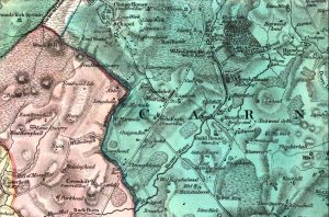
Forest Map
mapA Forest Map from 1819. This is the first detailed map of Lanarkshire to show the Wilsontown Iron Works. It even shows the furnace and a rail road that went…