
Maps
Narrow by year:
Narrow by location:
Narrow by tag:
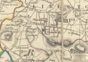
Thomsons Map of Nethertown
mapThomson map of Netherton and surrounding areas from 1832. The map shows more detail than Forest’s map of 1816, particularly in respect of roads. It also shows that Netherton had…
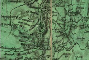
Forest Map of Lesmahagow
mapThe Forest Map of Lesmahagow from 1819. The detail of this map is better and more precise than the Ross Map of Lesmahagow from 1773. The map shows the owners…
Ross Map of Lesmahagow
mapThe Ross Map of Lesmahagow from 1773. The detail in the map does not quite match that of Roys’ map, but it does show some of the dwellings and farms…
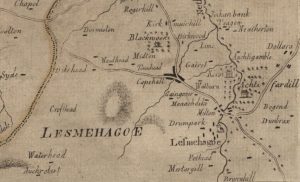
Thomson Map of Lesmahagow
mapThe Thomson Map of Lesmahagow from 1832. The map shows interesting features such as Goldrig, a castle in ruines near Dumbraxhill, and other interesting features such as lint mills and…
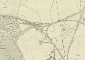
Lampits Ferry
mapThis map of c.1864 shows the position of the Lampits Ferry and how Smiths Bakers van would get to Pettinain. The map also shows the Village of Pettinain, which was…
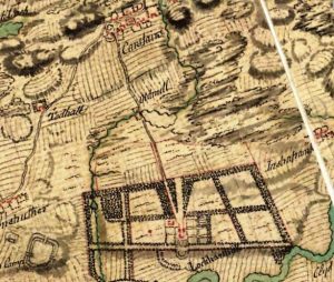
William Roy map of Carstairs
mapThe William Roy map shows the village of Carstairs with properties marked out. Of much interest is Carstairs House, which was – at this point – still occupied by the…
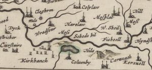
Blaeu map of Columbie
mapA Blaeu map of Columbie (Carstairs), completed by Joan Blaeu in the mid-17th century. The map references Columbie instead of Carstairs. Later maps of the area show Columbie Farm. Blaeu…
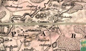
Forest map of Carstairs
mapThe Forest map of Carstairs from 1819. The map includes interesting details showing milestones and Tolls, as well as Columbie Farm, the Manse, as well as an old mill. Map…
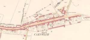
25″ Ordnance Survey map of Carnwath
mapA 25″ Ordnance Survey (OS) map of Carnwath from 1858. The map shows the position of the Lockhart Arms Inn, which is now a farm. The tavern was one of…
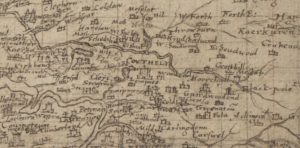
Pont map of Carnwath
mapThis is the Timothy Pont map of Carnwath from 1596. It later formed the basis of the map created by Joan Blaeu of the Netherlands. The map does not mention…