
![]()
Welcome to Clydesdale's Heritage, a project aimed at encouraging all people to take an active interest in the heritage and history of the Clydesdale area.
This website is one of several initiatives from Lanark and District Archaeology Society (LADAS) to encourage engagement with the history of the region.
The project includes lecture programmes, fieldwalks, cataloguing artefacts, inspiring school pupils during talks and presentations, and working with like-minded organisations – with the end goal being to record and preserve the heritage of Clydesdale.
Most popular this month
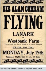
Sir Alan Cobham, Youth of Britain Tour
documentSir Alan John Cobham, KBE, AFC (6 May 1894 – 21 October 1973) was an English aviation pioneer. In 1929 Cobham mounted his first tour of Britain, called the Municipal…
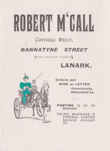
Robert McCall, Carriage Hirer
documentAn advertising document produced for Robert McCall, a carriage hirer based in Lanark. McCall’s likely operated from the Victoria Hotel/Royal Oak Hotel, with most trips being to the Falls of…

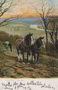
“Going to work”
postcardThe Clydesdale Horses were first successfully developed as a breed by the Patersons of Lochlyoch Farm near Carmichael in 1713. Apparently, the breed was improved by using a Flemish Stallion.…
Rural Life, Clydesdale Horses
postcardThe Clydesdale Horses were first successfully developed as a breed by the Patersons of Lochlyoch Farm near Carmichael in 1713. Apparently, the breed was improved by using a Flemish Stallion.…
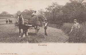
Clydesdale Horses being used for harvesting
postcardThe Clydesdale Horses were first successfully developed as a breed by the Patersons of Lochlyoch Farm near Carmichael in 1713. Apparently, the breed was improved by using a Flemish Stallion.…
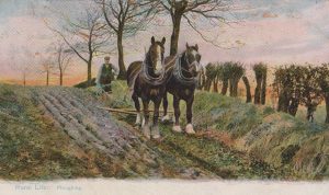
Rural Life – Ploughing
postcardThe Clydesdale Horses were first successfully developed as a breed by the Patersons of Lochlyoch Farm near Carmichael in 1713. Apparently, the breed was improved by using a Flemish Stallion.…
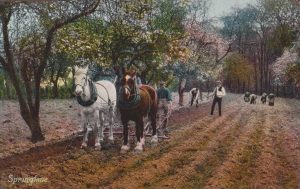
Clydesdale Horses in springtime
postcardThe Clydesdale Horses were first successfully developed as a breed by the Patersons of Lochlyoch Farm near Carmichael in 1713. Apparently, the breed was improved by using a Flemish Stallion.…
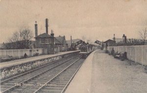
The Station at Thankerton
postcardThis is a great card showing the facilities at Thankerton Railway Station that included a goods yard plus a place to put water in a train’s boiler. Also, there is…
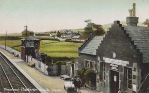
Townhead, Thankerton from the station
postcardThis is a nice view of the Station building at Thankerton with the adjacent signal box. The card dates to about 1905. Notice the advert for the Central Station Hotel…
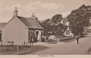
Thankerton Toll
postcardThis is a picture of the Thankerton Toll. In the days before the railways, money was raised for road maintenance through levying tolls. This toll house is typical of its…
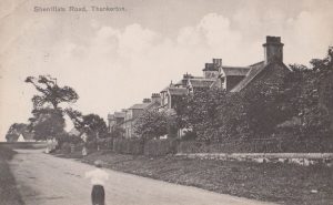
Sherrifflats Road, Thankerton
postcardA postcard showing Sherrifflats Road, Thankerton. The card was sent from the village on 23 August, 1911. The card was addressed to Nurse Dudley at the Nursing Home in Holland…
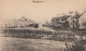
View of Thankerton with Post Office
postcardThis postcard, produced for John Forrest of the Post Office in Thankerton, shows the contrast between the old and new houses in Thankerton. It clearly indicates that there was a…